


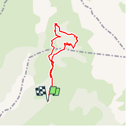


10.6 km | 24 km-effort


User


FREE GPS app for hiking
 SityTrail
IGN / Geographical institutes
SityTrail World
The world is yours!
Trail Walking of 6.7 km to be discovered at Provence-Alpes-Côte d'Azur, Hautes-Alpes, Saint-Firmin. This trail is proposed by yveshumbert.
Suivre le sentier découverte depuis la maison forestière des Vachers.
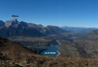
Walking

Walking

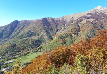
Touring skiing

Touring skiing
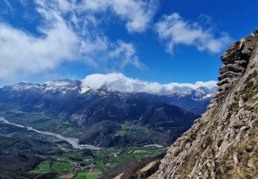
Walking

Walking

Walking
Walking

Walking