Trail Walking L'Abbaye - Balade des Bioux au Sentier - Photo
 danihz
danihz

User

© OpenStreetMap contributors
Length
Length
4.1 km
Max alt
Max alt
1021 m
Uphill gradient
Uphill gradient
29 m
Km-Effort
Km-Effort  
4.4 km
Min alt
Min alt
1002 m
Downhill gradient
Downhill gradient
24 m
Boucle
Boucle
No
Creation date :
2015-08-14 00:00:00.0
Updated on :
2015-08-14 00:00:00.0

(0 Reviews)

Walking
Walking
1h00
Difficulty : Very easy

Scan this QR Code to open this trail in the SityTrail application

FREE GPS app for hiking

Logo SityTrail SityTrail

IGN / Geographical institutes

Download SityTrail from the App Store Download SityTrail from Google Play

Logo SityTrail SityTrail World

The world is yours!

Download SityTrail from the App Store Download SityTrail from Google Play Download SityTrail on Huawei AppGallery

About

Trail Walking of 4.1 km to be discovered at Vaud, District du Jura-Nord vaudois, L'Abbaye. This trail is proposed by danihz.

Description

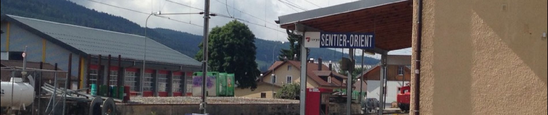
Très jolie balade près du Lac de Joux entre les Bioux et Le Sentier, à faire en famille. Peut se faire dans les 2 sens ou encore en aller retour. Départ de la base nautique des Bioux: Altitude 1004 (location de pédalos, de puddles, etc) et arrivée à la gare du Sentier (arrêt du bus pour les Bioux).
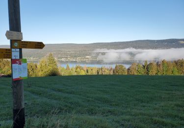
Le Sentier suit le bord du lac dans un très joli décor, avant de longer une roselière. Depuis la route que le sentier traverse, l'itinéraire se prolonge dans une petite forêt avec un sentier nature sympa.

Elevation profile

Photos

Positioning

Country:
Switzerland
Region :
Vaud
Department/Province :
District du Jura-Nord vaudois
Municipality :
L'Abbaye
Location:
Unknown
Start:(UTM)
290514 ; 5166500 (32T) N.

Trails nearby

Trail Walking L'Abbaye - Suisse Le Mont tendre - Photo
Walking
ericf64

Walking

Medium
L'Abbaye, Vaud, District du Jura-Nord vaudois, Switzerland
15 km | 24 km-effort
5h 2min
Yes
Trail Walking Le Chenit - Le Brassus (Genferseegebiet) - Photo
Walking
GUIDE+

Walking

Very easy
Le Chenit, Vaud, District du Jura-Nord vaudois, Switzerland
14.9 km | 23 km-effort
Unknown
No
Trail Walking Le Chenit - Le Brassus -  Combe des Amburnex 23.07.2018 - Photo
Walking
duamerg

Walking

Medium
Le Chenit, Vaud, District du Jura-Nord vaudois, Switzerland
15.7 km | 22 km-effort
4h 43min
Yes
Trail Snowshoes Le Chenit - 31-01-2012 - Photo
Snowshoes
enthalpie

Snowshoes

Medium
Le Chenit, Vaud, District du Jura-Nord vaudois, Switzerland
13.8 km | 18.9 km-effort
Unknown
No
Trail Snowshoes Le Chenit - 30-01-2012 - Photo
Snowshoes
enthalpie

Snowshoes

Difficult
Le Chenit, Vaud, District du Jura-Nord vaudois, Switzerland
15.4 km | 23 km-effort
Unknown
Yes
Trail Other activity Le Chenit - Le Brassus - La Givrine - Photo
Other activity
pierrepraz

Other activity

Very easy
Le Chenit, Vaud, District du Jura-Nord vaudois, Switzerland
21 km | 29 km-effort
Unknown
No
Trail Other activity Le Chenit - refuges  risou - Photo
Other activity
bertrandrimaz

Other activity

Very easy
Le Chenit, Vaud, District du Jura-Nord vaudois, Switzerland
10.8 km | 15.6 km-effort
Unknown
Yes
Trail Other activity Le Lieu - Allemagne-Fougères - Photo
Other activity
LuBa

Other activity

Very easy
Le Lieu, Vaud, District du Jura-Nord vaudois, Switzerland
7.5 km | 11.2 km-effort
Unknown
Yes
Trail Other activity Le Chenit - le croue - Photo
Other activity
mike

Other activity

Very easy
Le Chenit, Vaud, District du Jura-Nord vaudois, Switzerland
52 km | 67 km-effort
Unknown
Yes


Close
My subscriptions