Trail Other activity Bougarber - Balade crêtes de bougarber et autour de Beyrie - Photo

Balade crêtes de bougarber et autour de Beyrie

© OpenStreetMap contributors
Length
Length
12.8 km
Max alt
Max alt
272 m
Uphill gradient
Uphill gradient
205 m
Km-Effort
Km-Effort  
15.6 km
Min alt
Min alt
161 m
Downhill gradient
Downhill gradient
205 m
Boucle
Boucle
Yes
Creation date :
2015-08-16 00:00:00.0
Updated on :
2015-08-16 00:00:00.0

(0 Reviews)

Other activity
Other activity
1h58
Difficulty : Easy

Scan this QR Code to open this trail in the SityTrail application

FREE GPS app for hiking

Logo SityTrail SityTrail

IGN / Geographical institutes

Download SityTrail from the App Store Download SityTrail from Google Play

Logo SityTrail SityTrail World

The world is yours!

Download SityTrail from the App Store Download SityTrail from Google Play Download SityTrail on Huawei AppGallery

About

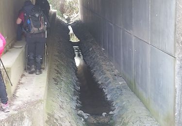
Trail Other activity of 12.8 km to be discovered at New Aquitaine, Pyrénées-Atlantiques, Bougarber. This trail is proposed by scapulaire64.

Description

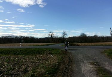
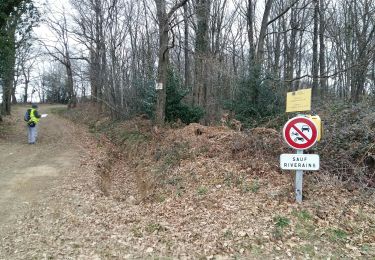
Depuis Bougarber passage sur les crêtes du Château puis descente sur le parcours  du trou au loup. Au niveau du départ du trou au loup on récupère le circuit du tour de Beyrie puis retour sur Bougarber et sa porte fortifiée.

Elevation profile

Positioning

Country:
France
Region :
New Aquitaine
Department/Province :
Pyrénées-Atlantiques
Municipality :
Bougarber
Location:
Unknown
Start:(UTM)
704837 ; 4808562 (30T) N.

Trails nearby

Trail Walking Bougarber - BOUGARBER   (PPT)balisage la boucle de la vallée de l'uzan fait 2305725 - Photo
Walking
GUIDE
marmotte65

Walking

Easy
Bougarber, New Aquitaine, Pyrénées-Atlantiques, France
10.6 km | 11.8 km-effort
6h 23min
Yes
Trail Walking Uzein - RS Uzein
Walking
GUIDE
marmotte65

Walking

Easy
Uzein, New Aquitaine, Pyrénées-Atlantiques, France
5.3 km | 5.6 km-effort
2h 11min
Yes
Trail Walking Beyrie-en-Béarn - BEYRIE en BEARN promenade autour de Beyrie 3180282 - Photo
Walking
GUIDE
marmotte65

Walking

Difficult
Beyrie-en-Béarn, New Aquitaine, Pyrénées-Atlantiques, France
10.6 km | 13.4 km-effort
2h 59min
Yes
Trail On foot Denguin - DENGUIN   (PPT) boucle du trou du loup balisage le 21 01 2020 - Photo
On foot
GUIDE
marmotte65

On foot

Very easy
Denguin, New Aquitaine, Pyrénées-Atlantiques, France
4 km | 5.4 km-effort
Unknown
Yes
Trail Walking Momas - G4 Momas - Photo
Walking
LouisROGER

Walking

Difficult
Momas, New Aquitaine, Pyrénées-Atlantiques, France
11 km | 13.3 km-effort
5h 21min
No
Trail Bicycle tourism Cescau - 7-3-2024 - Photo
Bicycle tourism
potofe

Bicycle tourism

Very difficult
Cescau, New Aquitaine, Pyrénées-Atlantiques, France
58 km | 70 km-effort
3h 33min
Yes
Trail Walking Beyrie-en-Béarn - 2022_10_27-Beyrie en Béarn - Photo
Walking
Jilot64

Walking

Medium
Beyrie-en-Béarn, New Aquitaine, Pyrénées-Atlantiques, France
8.9 km | 11.4 km-effort
3h 0min
Yes
Trail Mountain bike Poey-de-Lescar - Poey de Lescar - les crêtes de l'Aubin  - Circuit long - 43Km - Photo
Mountain bike
potofe

Mountain bike

Difficult
Poey-de-Lescar, New Aquitaine, Pyrénées-Atlantiques, France
43 km | 54 km-effort
2h 50min
Yes
Trail On foot Mazerolles - MAZEROLLES  (Labarraque parking) L  ac de l'Aygue longue  (RS) - Photo
On foot
GUIDE
marmotte65

On foot

Very easy
Mazerolles, New Aquitaine, Pyrénées-Atlantiques, France
4.5 km | 5 km-effort
Unknown
Yes


Close
My subscriptions