


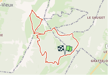
2015-09-10 Marche Mont Colombier

holtzv
User GUIDE

Length
10.4 km

Max alt
2030 m

Uphill gradient
870 m
Km-Effort
22 km

Min alt
1181 m

Downhill gradient
873 m
Boucle
Yes
Creation date :
2015-09-10 00:00:00.0
Updated on :
2015-09-10 00:00:00.0
4h37
Difficulty : Medium

FREE GPS app for hiking
 SityTrail
IGN / Geographical institutes
SityTrail Plus
The world is yours!
About
Trail Walking of 10.4 km to be discovered at Auvergne-Rhône-Alpes, Savoy, Aillon-le-Jeune. This trail is proposed by holtzv.
Positioning
Country:
France
Region :
Auvergne-Rhône-Alpes
Department/Province :
Savoy
Municipality :
Aillon-le-Jeune
Location:
Unknown
Start:(Dec)
Start:(UTM)
276446 ; 5056947 (32T) N.
Comments