Trail Walking Souvignargues - 30 SOUVIGNARGUES - circuit mas Du Fort, ST-ETIENNE-D'ESCATTES - église ST-ANDRÉ  - Photo

30 SOUVIGNARGUES - circuit mas Du Fort, ST-ETIENNE-D'ESCATTES - église ST-ANDRÉ

 jeff66
jeff66

User

© OpenStreetMap contributors
Length
Length
13.1 km
Max alt
Max alt
130 m
Uphill gradient
Uphill gradient
198 m
Km-Effort
Km-Effort  
15.7 km
Min alt
Min alt
48 m
Downhill gradient
Downhill gradient
198 m
Boucle
Boucle
Yes
Creation date :
2016-03-09 00:00:00.0
Updated on :
2016-03-09 00:00:00.0

(0 Reviews)

Walking
Walking
2h23
Difficulty : Medium

Scan this QR Code to open this trail in the SityTrail application

FREE GPS app for hiking

Logo SityTrail SityTrail

IGN / Geographical institutes

Download SityTrail from the App Store Download SityTrail from Google Play

Logo SityTrail SityTrail World

The world is yours!

Download SityTrail from the App Store Download SityTrail from Google Play Download SityTrail on Huawei AppGallery

About

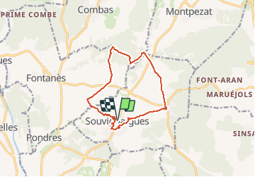
Trail Walking of 13.1 km to be discovered at Occitania, Gard, Souvignargues. This trail is proposed by jeff66.

Description

30 SOUVIGNARGUES - parking à proximité de la mairie, rue du l'avoir, la
Cecilette, la circulade, place du cèdre - puech Ravanas - ruisseau d'Aigalade
- la roque - ruisseau Valat de Faysses - P.i. Serre de Sioure - aller de mûriers vers le mas de Guyot - serre des bruyères. Traverser la D107 - la font des Cauliasses - P.i. mas d'Aubas - piste en Forêt méditerranéenne - la paillade - tourille de Doumergues - P.i. Tour de Pintard - traverser la D22 , puis P.i. Ch. de Combas - vue sur la Plaine, le Pic St Loup, les Cévennes - Combe de Dort - COSTE Sorbières -  P.i. Et Valat de la Bastide puis Valat de la Rompue - traverser la D103, emprunter la D107, vers ST-ETIENNE-D'ESCATTES, place et rue de l'Eglise - Passage à gué Vallat d'Ezort - la balance - Puech coucou - église ST-ANDRÉ - P.i le grès - rues de la carrière, des aires, temple, cave Coop, traverser route de Sommieres, RD22, rue du Besal, P.i. Barbière, rue du parc, chemin de l'enclos, rue du vieux village, place de l'église, rue de la ronde, impasse du château

Elevation profile

Photos

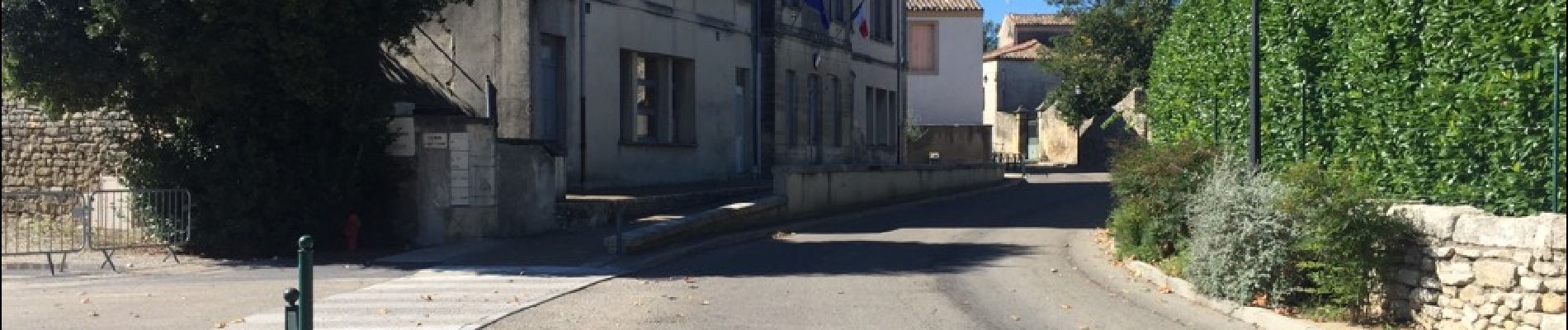
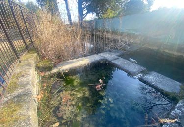
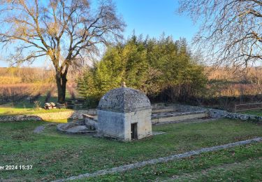
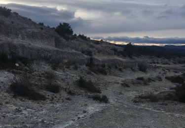
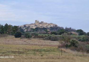
27 photos in total. Please click on a photo to see them all in the gallery.

Positioning

Country:
France
Region :
Occitania
Department/Province :
Gard
Municipality :
Souvignargues
Location:
Unknown
Start:(UTM)
590345 ; 4851950 (31T) N.

Trails nearby

Trail Walking Fontanès - FONTANÉS 30 - SALINELLES - PONDRES - ballade autour du Vidourle  - Photo
Walking
jeff66

Walking

Medium
(2)
Fontanès, Occitania, Gard, France
10.7 km | 12.7 km-effort
1h 59min
Yes
Trail Walking Sommières -  SOMMIERES 30 - VILLEVIEILLE châteaux- JUNAS les carrières  - Photo
Walking
jeff66

Walking

Medium
(2)
Sommières, Occitania, Gard, France
14 km | 16.9 km-effort
2h 34min
Yes
Trail Walking Junas - Entre Junas et Aujargues - Photo
Walking
GUIDE
randotines

Walking

Easy
Junas, Occitania, Gard, France
7.9 km | 9.4 km-effort
2h 2min
Yes
Trail Walking Sommières - Autour de Villevielle 30 - Photo
Walking
guignier

Walking

Easy
(2)
Sommières, Occitania, Gard, France
10.5 km | 12.3 km-effort
3h 0min
Yes
Trail Walking Souvignargues - Saint Étienne d’Escattes - Photo
Walking
GUIDE
Roger Philippe Wallez

Walking

Very difficult
Souvignargues, Occitania, Gard, France
16.9 km | 22 km-effort
4h 58min
Yes
Trail Walking Salinelles - salinelles-pondres-souvignargues-fontanes - Photo
Walking
v.rabot

Walking

Medium
Salinelles, Occitania, Gard, France
14.7 km | 17.2 km-effort
4h 14min
Yes
Trail Walking Sommières - Les matches de géants  - Photo
Walking
gscholasch

Walking

Easy
Sommières, Occitania, Gard, France
48 km | 67 km-effort
3h 29min
No
Trail Walking Combas - Combats Montpezat - Photo
Walking
v.rabot

Walking

Difficult
Combas, Occitania, Gard, France
14.2 km | 17.4 km-effort
3h 57min
Yes
Trail Walking Combas - Combas - Photo
Walking
guyzinz

Walking

Very difficult
Combas, Occitania, Gard, France
16.6 km | 22 km-effort
6h 8min
Yes


Close
My subscriptions