


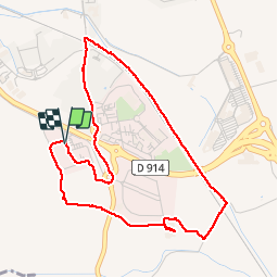
66 PERPIGNAN - Technosud Agrosud, promenade en périphérie de la cité

jeff66
User


49m
Difficulty : Easy

FREE GPS app for hiking
 SityTrail
IGN / Geographical institutes
SityTrail Plus
The world is yours!
About
Trail Walking of 5 km to be discovered at Occitania, Pyrénées-Orientales, Perpignan. This trail is proposed by jeff66.
Description
66 PERPIGNAN - Technosud Agrosud, mas Eycheynne Gran, mas Delfau, traverser puis longer voie SNCF, chemin de terre entre voies ferrées et canal, passer sous RN114, passer à proximité de la caserne des pompiers, de jardiland, du bowling de conforama, mas Balande, croix rouge française maison de retraite le hameau DANTJOU - avenue Albert Einstein - Texhnosud passage sous la RN114 - Agrosud - rond point du VC5 chemin de Perpignan à Villeneuve de la raho -
Positioning
Comments