Trail Winter sports Saint-Jean-de-Gonville - VTT 2003-06-22 - Photo
 anselmo
anselmo

User

© OpenStreetMap contributors
Length
Length
47 km
Max alt
Max alt
1197 m
Uphill gradient
Uphill gradient
1376 m
Km-Effort
Km-Effort  
65 km
Min alt
Min alt
353 m
Downhill gradient
Downhill gradient
1375 m
Boucle
Boucle
Yes
Creation date :
2014-12-10 00:00:00.0
Updated on :
2014-12-10 00:00:00.0

(0 Reviews)

Winter sports
Winter sports
--
Difficulty : Unknown

Scan this QR Code to open this trail in the SityTrail application

FREE GPS app for hiking

Logo SityTrail SityTrail

IGN / Geographical institutes

Download SityTrail from the App Store Download SityTrail from Google Play

Logo SityTrail SityTrail World

The world is yours!

Download SityTrail from the App Store Download SityTrail from Google Play Download SityTrail on Huawei AppGallery

About

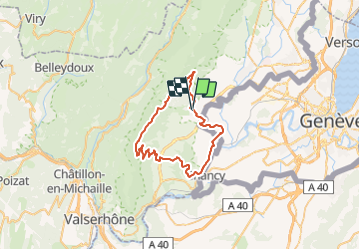
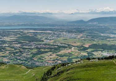
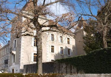
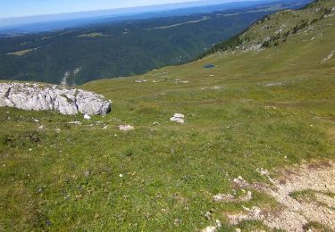
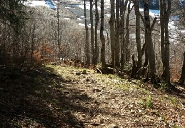
Trail Winter sports of 47 km to be discovered at Auvergne-Rhône-Alpes, Ain, Saint-Jean-de-Gonville. This trail is proposed by anselmo.

Description

50 Kms du Rhone au Jura
12 Km de montée depuis Farges

Elevation profile

Positioning

Country:
France
Region :
Auvergne-Rhône-Alpes
Department/Province :
Ain
Municipality :
Saint-Jean-de-Gonville
Location:
Unknown
Start:(UTM)
727930 ; 5121779 (31T) N.

Trails nearby

Trail Walking Thoiry - Le Reculet Le Crêt de la Neige - Photo
Walking
dominiq

Walking

Difficult
(1)
Thoiry, Auvergne-Rhône-Alpes, Ain, France
10.7 km | 23 km-effort
4h 39min
Yes
Trail Walking Thoiry - Le Reculet  - Photo
Walking
Arvierie56@Gmail.com

Walking

Difficult
Thoiry, Auvergne-Rhône-Alpes, Ain, France
11.2 km | 26 km-effort
4h 29min
Yes
Trail Walking Thoiry - Crêt de la Neige et Reculet - Thoiry - Photo
Walking
tracegps

Walking

Difficult
Thoiry, Auvergne-Rhône-Alpes, Ain, France
10.6 km | 23 km-effort
5h 15min
Yes
Trail Walking Challex - Circuit du vignoble - Challex - Photo
Walking
tracegps

Walking

Easy
Challex, Auvergne-Rhône-Alpes, Ain, France
7 km | 8.8 km-effort
1h 45min
Yes
Trail Walking Chézery-Forens - Chezery Le Reculet  - Photo
Walking
Jackoyo

Walking

Difficult
Chézery-Forens, Auvergne-Rhône-Alpes, Ain, France
9.4 km | 19.4 km-effort
3h 2min
Yes
Trail Walking Chézery-Forens - Reculet Curson Crêt de la neige - Photo
Walking
Praff

Walking

Very easy
Chézery-Forens, Auvergne-Rhône-Alpes, Ain, France
13.5 km | 26 km-effort
5h 14min
Yes
Trail Walking Dardagny - wa31 - Photo
Walking
GUIDE+

Walking

Very easy
Dardagny, Geneva, Unknown, Switzerland
14.5 km | 17.2 km-effort
Unknown
No
Trail Walking Dardagny - Au bord d''Allondon - Photo
Walking
GUIDE+

Walking

Very easy
Dardagny, Geneva, Unknown, Switzerland
6.3 km | 8.3 km-effort
Unknown
No
Trail Walking Thoiry - 05.01 - Photo
Walking
monique surace

Walking

Thoiry, Auvergne-Rhône-Alpes, Ain, France
12.1 km | 14.3 km-effort
1h 20min
No


Close
My subscriptions