


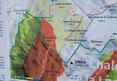
6.2 km | 9.9 km-effort


User


FREE GPS app for hiking
 SityTrail
IGN / Geographical institutes
SityTrail World
The world is yours!
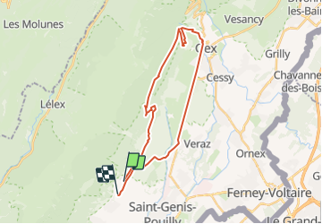
Trail Other activity of 28 km to be discovered at Auvergne-Rhône-Alpes, Ain, Sergy. This trail is proposed by anselmo.
50 Kms du Rhone au Jura
12 Km de montée depuis Farges
Snowshoes
Mountain bike
Walking
Walking
Walking

Walking
Walking

Walking

Walking