Trail Walking Orsières - Ferret, Les Cols Ferret - Photo

Ferret, Les Cols Ferret

 rpf
rpf

User

© OpenStreetMap contributors
Length
Length
10 km
Max alt
Max alt
2560 m
Uphill gradient
Uphill gradient
608 m
Km-Effort
Km-Effort  
18.1 km
Min alt
Min alt
2067 m
Downhill gradient
Downhill gradient
608 m
Boucle
Boucle
Yes
Creation date :
2014-12-10 00:00:00.0
Updated on :
2014-12-10 00:00:00.0

(0 Reviews)

Walking
Walking
5h30
Difficulty : Unknown

Scan this QR Code to open this trail in the SityTrail application

FREE GPS app for hiking

Logo SityTrail SityTrail

IGN / Geographical institutes

Download SityTrail from the App Store Download SityTrail from Google Play

Logo SityTrail SityTrail World

The world is yours!

Download SityTrail from the App Store Download SityTrail from Google Play Download SityTrail on Huawei AppGallery

About

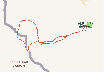
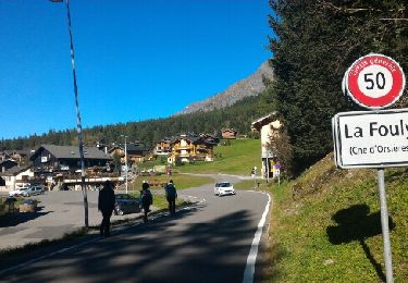
Trail Walking of 10 km to be discovered at Valais/Wallis, Entremont, Orsières. This trail is proposed by rpf.

Description

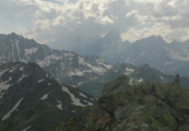
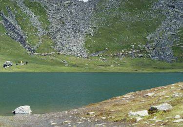
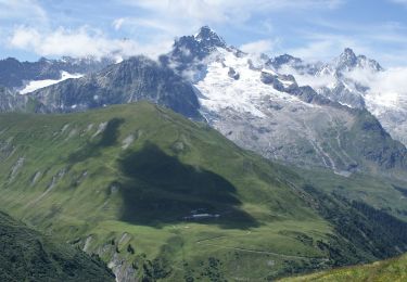
Très jolie randonnée autour de la Tête de Ferret par le Grand et le Petit Col Ferret. Magnifique vue sur le Val Ferret Italien et la partie orientale du massif Mont-Blanc, sur les Grandes Jorasses, les Aiguilles de Leschaux, de Talèfre et du Triolet, sur le Mont Dolent et la Pointe des Allobroges.

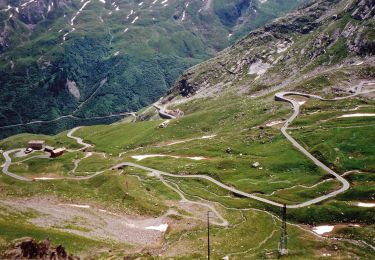
Départ à l''alpage de la Peule, accessible "pour les riverains" par une route en terre battue en assez bon état.
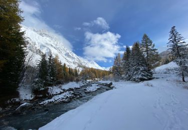
L''itinéraire ne pose aucune difficulté, mais il est conseillé de la faire avant l''arrivée de la neige.

Une balade de  " www.toprando.ch "

Elevation profile

Positioning

Country:
Switzerland
Region :
Valais/Wallis
Department/Province :
Entremont
Municipality :
Orsières
Location:
Unknown
Start:(UTM)
353552 ; 5084338 (32T) N.

Trails nearby

Trail Walking Bourg-Saint-Pierre - st. Bernard - Photo
Walking
PurroB

Walking

Very easy
(2)
Bourg-Saint-Pierre, Valais/Wallis, Entremont, Switzerland
44 km | 116 km-effort
6h 17min
No
Trail On foot Bourg-Saint-Pierre - Chemins pédestres, région St-Bernard - Photo
On foot
PRO

On foot

Easy
Bourg-Saint-Pierre, Valais/Wallis, Entremont, Switzerland
8.6 km | 18.8 km-effort
4h 15min
No
Trail On foot Bourg-Saint-Pierre - Via Alpina Red R117 - Photo
On foot
PRO

On foot

Very difficult
Bourg-Saint-Pierre, Valais/Wallis, Entremont, Switzerland
27 km | 46 km-effort
10h 25min
No
Trail On foot Orsières - Trail Verbier St-Bernard - Traversée - Photo
On foot
PRO

On foot

Very difficult
Orsières, Valais/Wallis, Entremont, Switzerland
37 km | 70 km-effort
15h 47min
No
Trail On foot Orsières - Sentier des Bergers - Photo
On foot
PRO

On foot

Easy
Orsières, Valais/Wallis, Entremont, Switzerland
4.8 km | 9.2 km-effort
2h 5min
No
Trail Walking Courmayeur - TMB J4 Ref.ELENA - COURMAYEUR - Photo
Walking
GerardBouche

Walking

Medium
Courmayeur, Aosta Valley, Unknown, Italy
13.5 km | 22 km-effort
4h 18min
No
Trail Walking Courmayeur - TMB day 4 - Photo
Walking
elixpomatia

Walking

Medium
Courmayeur, Aosta Valley, Unknown, Italy
16.6 km | 27 km-effort
5h 37min
No
Trail Walking Orsières - La Fouly, Randonée hivernale, Sentier de l''Amône  - Photo
Walking
verbier

Walking

Very easy
(1)
Orsières, Valais/Wallis, Entremont, Switzerland
1.9 km | 2.7 km-effort
50min
Yes
Trail Walking Orsières - ferret La Foully - Photo
Walking
michauxpaul

Walking

Medium
Orsières, Valais/Wallis, Entremont, Switzerland
4.6 km | 6.1 km-effort
2h 20min
No


Close
My subscriptions