Trail Walking Courmayeur - TMB J4 Ref.ELENA - COURMAYEUR - Photo

TMB J4 Ref.ELENA - COURMAYEUR

© OpenStreetMap contributors
Length
Length
13.5 km
Max alt
Max alt
2075 m
Uphill gradient
Uphill gradient
500 m
Km-Effort
Km-Effort  
22 km
Min alt
Min alt
1613 m
Downhill gradient
Downhill gradient
930 m
Boucle
Boucle
No
Creation date :
2017-02-05 00:00:00.0
Updated on :
2017-02-05 00:00:00.0

(0 Reviews)

Walking
Walking
4h18
Difficulty : Medium

Scan this QR Code to open this trail in the SityTrail application

FREE GPS app for hiking

Logo SityTrail SityTrail

IGN / Geographical institutes

Download SityTrail from the App Store Download SityTrail from Google Play

Logo SityTrail SityTrail World

The world is yours!

Download SityTrail from the App Store Download SityTrail from Google Play Download SityTrail on Huawei AppGallery

About

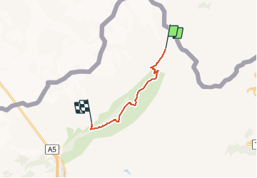
Trail Walking of 13.5 km to be discovered at Aosta Valley, Unknown, Courmayeur. This trail is proposed by GerardBouche.

Description

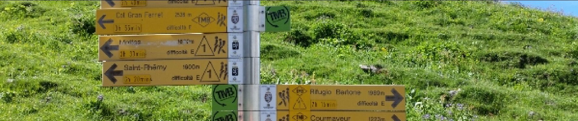
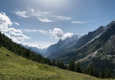
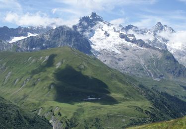
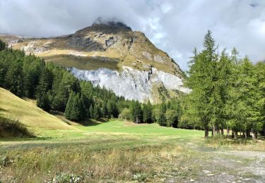
Depuis le refuge montée jusqu'au refuge Bonatti. La traversée du en balcon du Mont de la Saxe offre une vue exceptionnelle sur le Mt-Blanc, le Mont Dolent, l'Aiguille du Trioletet les Grandes Jorasses. Descente vers Courmayeur avec court transfert en bus vers le gîte sur les hauteurs de Courmayeur.

Elevation profile

Photos

Positioning

Country:
Italy
Region :
Aosta Valley
Department/Province :
Unknown
Municipality :
Courmayeur
Location:
Unknown
Start:(UTM)
349892 ; 5083063 (32T) N.

Trails nearby

Trail On foot Courmayeur - Alta Via n. 1 della Valle d'Aosta - Tappa 17 - Photo
On foot
PRO

On foot

Easy
Courmayeur, Aosta Valley, Unknown, Italy
11.9 km | 18.2 km-effort
4h 8min
No
Trail On foot Courmayeur - (SI F09) Rifugio Bonatti - Rifugio Frassati - Photo
On foot
PRO

On foot

Easy
Courmayeur, Aosta Valley, Unknown, Italy
7.5 km | 17.6 km-effort
4h 0min
No
Trail On foot Orsières - Sentier des Bergers - Photo
On foot
PRO

On foot

Easy
Orsières, Valais/Wallis, Entremont, Switzerland
4.8 km | 9.2 km-effort
2h 5min
No
Trail On foot Courmayeur - Itinerario 23 Rifugio Dalmazzi - Photo
On foot
PRO

On foot

Easy
Courmayeur, Aosta Valley, Unknown, Italy
4.1 km | 6.6 km-effort
1h 29min
No
Trail Walking Courmayeur - TMB day 4 - Photo
Walking
elixpomatia

Walking

Medium
Courmayeur, Aosta Valley, Unknown, Italy
16.6 km | 27 km-effort
5h 37min
No
Trail Walking Orsières - fully  - Photo
Walking
suzanne.bron

Walking

Easy
Orsières, Valais/Wallis, Entremont, Switzerland
3.8 km | 4.9 km-effort
1h 19min
No
Trail Walking Courmayeur - TMB6 AN - Photo
Walking
reneperrin

Walking

Easy
Courmayeur, Aosta Valley, Unknown, Italy
12.6 km | 21 km-effort
4h 5min
No
Trail Walking Courmayeur - TMB 06 - Arnouva -> La Fouly - Photo
Walking
uru2010

Walking

Difficult
Courmayeur, Aosta Valley, Unknown, Italy
15.4 km | 26 km-effort
6h 19min
No
Trail Walking Orsières - TMB 6 - Photo
Walking
pensionisten71

Walking

Medium
Orsières, Valais/Wallis, Entremont, Switzerland
6.2 km | 7.9 km-effort
1h 46min
No


Close
My subscriptions