Trail Walking Montner - 66 FORÇA RÉAL, jardin botanique, boucle versant Nord, MONTNER - Photo

66 FORÇA RÉAL, jardin botanique, boucle versant Nord, MONTNER

 jeff66
jeff66

User

© OpenStreetMap contributors
Length
Length
6.9 km
Max alt
Max alt
493 m
Uphill gradient
Uphill gradient
311 m
Km-Effort
Km-Effort  
11.1 km
Min alt
Min alt
177 m
Downhill gradient
Downhill gradient
313 m
Boucle
Boucle
Yes
Creation date :
2015-11-28 00:00:00.0
Updated on :
2015-11-28 00:00:00.0

(1 Reviews)

Walking
Walking
1h33
Difficulty : Medium

Scan this QR Code to open this trail in the SityTrail application

FREE GPS app for hiking

Logo SityTrail SityTrail

IGN / Geographical institutes

Download SityTrail from the App Store Download SityTrail from Google Play

Logo SityTrail SityTrail Plus

The world is yours!

Download SityTrail from the App Store Download SityTrail from Google Play Download SityTrail on Huawei AppGallery

About

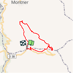
Trail Walking of 6.9 km to be discovered at Occitania, Pyrénées-Orientales, Montner. This trail is proposed by jeff66.

Description

66 FORÇA RÉAL, coll de Bou, vue sur les corbières, LA
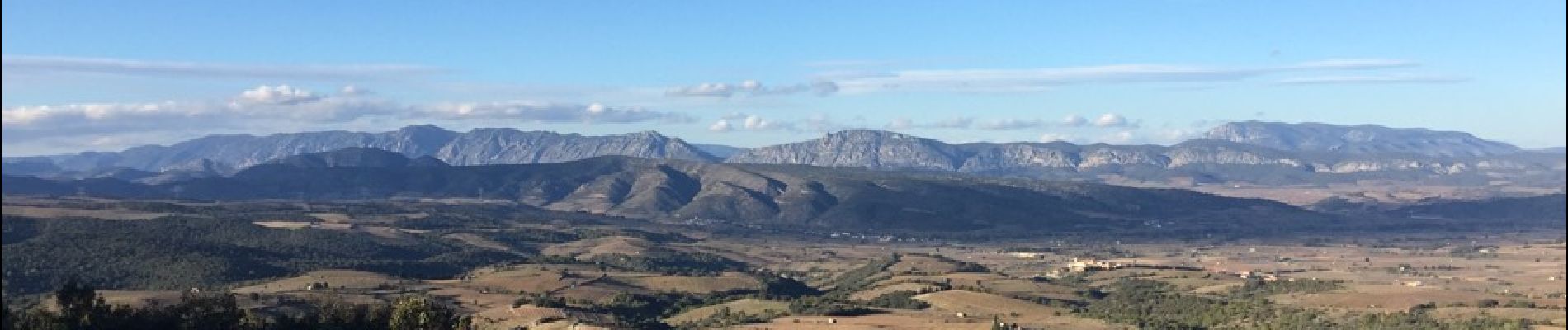
Vallée de l'agly, Sentier botanique, relai et ermitage de força réal, vue à 250 degrés sur la vallée de la Tet, la plaine, les Albères, la côte, les corbières m, la vallée de l'agly, le Canigou les Pyrénées - MONTNER - ravin de las Pichadousses

Elevation profile

Photos

35 photos in total. Please click on a photo to see them all in the gallery.

Positioning

Country:
France
Region :
Occitania
Department/Province :
Pyrénées-Orientales
Municipality :
Montner
Location:
Unknown
Start:(UTM)
474014 ; 4730634 (31T) N.

Comments

Please log in to post a review or rate the element


Une partie du chemin n’existe plus pour la traversée du ravin


Close
My subscriptions