


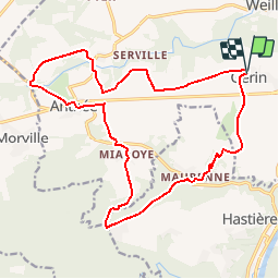

20 km | 25 km-effort


User GUIDE


FREE GPS app for hiking
 SityTrail
IGN / Geographical institutes
SityTrail World
The world is yours!
Trail Walking of 18.1 km to be discovered at Wallonia, Namur, Onhaye. This trail is proposed by Desrumaux.
ANTHEE est un charmant petit village situé dans la commune d’Onhaye, sur les hauteurs de Dinant.
C'est à Anthée, au XIXe s, que fut découverte une des plus importantes villas gallo-romaines du pays. Composé du XVIe au début XVIIIe siècle, le château-ferme de la Forge de style français du XVIIIe siècle est une construction en U, faite de calcaire, brique et pierre bleue. Le château d’Ostemerée aux clochetons élégants est du début du XXème siècle
MAURENNE est caractérisé par la présence de deux grosses fermes dont l'une prend l'allure de château. Belles maisons en pierres de pays.
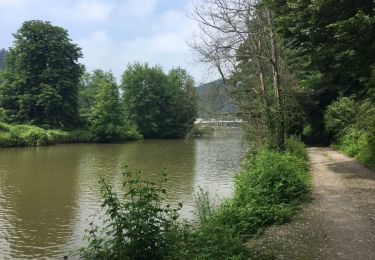
Ce petit havre de paix avec seulement 60 habitants se situe sur un petit promontoire longé par le ruisseau « Le Feron ». Le relief y est très accidenté.
Départ : Eglise de Gérin ou église d’Anthée.
Détails sur TraceGPS.com
http://www.tracegps.com/fr/parcours/circuit9276.htm#

Walking

Walking

Walking

Walking

Walking

Walking

Walking

Walking
très belle randonnée variée