


La Bessade- La Forêt

houbart
User
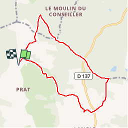

Length
8.4 km

Max alt
464 m

Uphill gradient
191 m
Km-Effort
10.9 km

Min alt
380 m

Downhill gradient
191 m
Boucle
Yes
Creation date :
2019-03-28 15:47:26.709
Updated on :
2019-03-28 15:47:26.752
2h21
Difficulty : Medium

FREE GPS app for hiking
 SityTrail
IGN / Geographical institutes
SityTrail Plus
The world is yours!
About
Trail Walking of 8.4 km to be discovered at New Aquitaine, Corrèze, Condat-sur-Ganaveix. This trail is proposed by houbart.
Description
Découverte du Ganaveix qui serpente à travers bois et prairies, des hameaux de caractère et un superbe panorama sur les Monédières.
Positioning
Country:
France
Region :
New Aquitaine
Department/Province :
Corrèze
Municipality :
Condat-sur-Ganaveix
Location:
Unknown
Start:(Dec)
Start:(UTM)
389524 ; 5040997 (31T) N.
Comments