66 COLLIOURE, Sentier littoral de la crique des Portells à COLLIOURE et retour

jeff66
User

Length
6.5 km

Max alt
58 m

Uphill gradient
124 m

Km-Effort
8.1 km

Min alt
-1 m

Downhill gradient
124 m
Boucle
Yes
Creation date :
2015-12-20 00:00:00.0
Updated on :
2015-12-20 00:00:00.0
1h30
Difficulty : Easy

FREE GPS app for hiking
About
Trail Walking of 6.5 km to be discovered at Occitania, Pyrénées-Orientales, Argelès-sur-Mer. This trail is proposed by jeff66.
Description
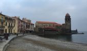
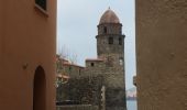
66 COLLIOURE, Sentier littoral de la crique des Portells, calanque et plage de L'Ouille, font d'en Bertrand, forts carré et Rodon, avenue du mirador, rue de San Sébastien, rue Dugommier, rue Dagobert, rue de l'église. Plage St vincent, Al Boramar, rue de la république, rue des palmiers. Parking Du Douy, RD114
Positioning
Country:
France
Region :
Occitania
Department/Province :
Pyrénées-Orientales
Municipality :
Argelès-sur-Mer
Location:
Unknown
Start:(Dec)
Start:(UTM)
505519 ; 4709053 (31T) N.
Comments


 SityTrail


