


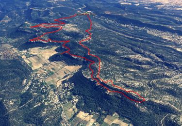
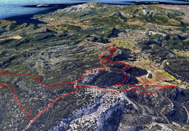
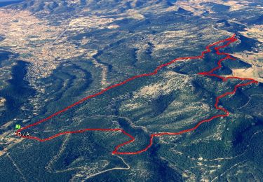
16.5 km | 24 km-effort


User


FREE GPS app for hiking
 SityTrail
IGN / Geographical institutes
SityTrail World
The world is yours!
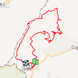
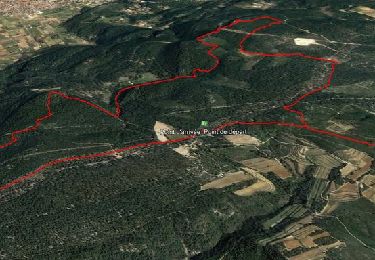
Trail Walking of 14.9 km to be discovered at Provence-Alpes-Côte d'Azur, Bouches-du-Rhône, Cuges-les-Pins. This trail is proposed by phidge.
P2 T2 Sur piste et GR98
Parking col de l'Ange 2 kms avant Cuges les Pins
Walking
Walking
Walking
Walking

Walking
Walking

Walking

Mountain bike

Walking