


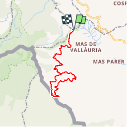


14.5 km | 19.1 km-effort


User


FREE GPS app for hiking
 SityTrail
IGN / Geographical institutes
SityTrail World
The world is yours!
Trail Walking of 17 km to be discovered at Occitania, Pyrénées-Orientales, Banyuls-sur-Mer. This trail is proposed by jeff66.
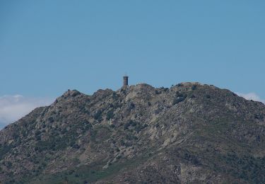
66 BANYULS-SUR-MER, col de Bailllaury, piste DFCI AL74, puix Empolla, Rec de Malaterra, citerne puis bassin, Rec del Bosc, frontière espagnole, borne 591, Route goudronnée puis piste, citerne rouillée N0 17, passage à gué et retenue d'eau 19, Rec d'en patllari, pistes DFCI AL54, 80, 79, vue sur le mas des abeilles, la tour Madeloc, reprendre la piste DFCI AL74


35 photos in total. Please click on a photo to see them all in the gallery.

Walking

Walking

Walking

Walking

Walking

Walking

Walking
On foot

Walking