


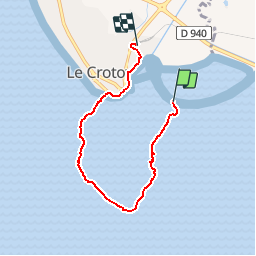

10.4 km | 12.2 km-effort


User


FREE GPS app for hiking
 SityTrail
IGN / Geographical institutes
SityTrail World
The world is yours!
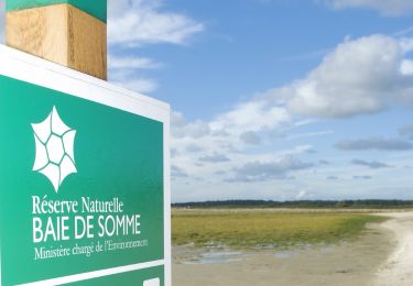
Trail Walking of 4.8 km to be discovered at Hauts-de-France, Somme, Favières. This trail is proposed by Cheyenne80.
balade dans la baie de Somme à partir de l'écluse retour au Crotoy

Walking
Walking

Walking

Walking
Walking

Walking

Mountain bike

Equestrian
Cycle