


St Setiers - Andouze

cron
User
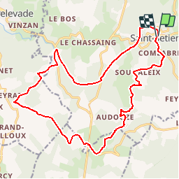

Length
21 km

Max alt
951 m

Uphill gradient
456 m
Km-Effort
28 km

Min alt
782 m

Downhill gradient
459 m
Boucle
Yes
Creation date :
2017-03-05 00:00:00.0
Updated on :
2017-03-05 00:00:00.0
5h53
Difficulty : Medium

FREE GPS app for hiking
 SityTrail
IGN / Geographical institutes
SityTrail Plus
The world is yours!
About
Trail Walking of 21 km to be discovered at New Aquitaine, Corrèze, Saint-Setiers. This trail is proposed by cron.
Positioning
Country:
France
Region :
New Aquitaine
Department/Province :
Corrèze
Municipality :
Saint-Setiers
Location:
Unknown
Start:(Dec)
Start:(UTM)
432200 ; 5060610 (31T) N.
Comments