


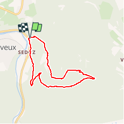

15.9 km | 21 km-effort

User


FREE GPS app for hiking
 SityTrail
IGN / Geographical institutes
SityTrail World
The world is yours!
Trail Walking of 6.7 km to be discovered at Wallonia, Liège, Aywaille. This trail is proposed by henriantoine.
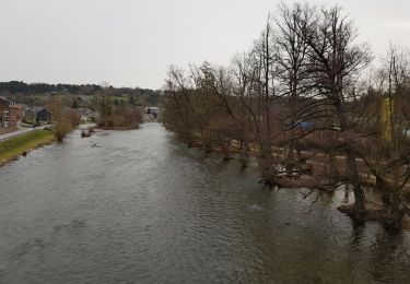
Classé patrimoine immobilier exceptionnel de wallonnie : Romantique remontée du ruisseau Ninglispo jusque Bain de Diane La Fourchette jusque le point de vue culminant DROUET Alt 315 m puis descente en foret vers le parking du point de départ.


Walking


Walking
Walking

Walking
Walking

Walking
Walking
Walking
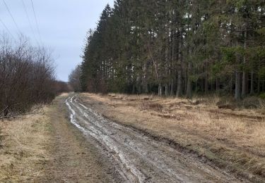
La 1ère partie (100m après le départ et jusqu'à la fourchette) est assez technique et glissante à certains endroits mais est sympa à faire. La 2ème partie est plus rectiligne et presque tout en descente (chemin routable empierré - les genoux sont content d'arriver en bas). Seul le point de vue comme point d'intérêt pour cette partie donc ça paraît plus long surtout avec des enfants.
très chouette balade dans un site magique.assez technique quand tout est gelé comme cette fois-ci. le Ninglinspo est à faire en toute saison. la deuxième partie de la balade est sur terrain facile à travers les bois.