


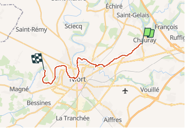
Chauray-La Roussille

olaze
User

Length
18.4 km

Max alt
81 m

Uphill gradient
111 m
Km-Effort
20 km

Min alt
5 m

Downhill gradient
179 m
Boucle
No
Creation date :
2016-03-16 00:00:00.0
Updated on :
2016-03-16 00:00:00.0
1h10
Difficulty : Easy

FREE GPS app for hiking
 SityTrail
IGN / Geographical institutes
SityTrail Plus
The world is yours!
About
Trail Cycle of 18.4 km to be discovered at New Aquitaine, Deux-Sèvres, Chauray. This trail is proposed by olaze.
Description
Par petites routes et rues
Positioning
Country:
France
Region :
New Aquitaine
Department/Province :
Deux-Sèvres
Municipality :
Chauray
Location:
Unknown
Start:(Dec)
Start:(UTM)
701715 ; 5137038 (30T) N.
Comments