Trail Walking Villelongue-dels-Monts - 66 VILLELONGUE-DELS-MONTS, entre Lac et Tech  - Photo

66 VILLELONGUE-DELS-MONTS, entre Lac et Tech

 jeff66
jeff66

User

© OpenStreetMap contributors
Length
Length
5.9 km
Max alt
Max alt
61 m
Uphill gradient
Uphill gradient
40 m
Km-Effort
Km-Effort  
6.4 km
Min alt
Min alt
37 m
Downhill gradient
Downhill gradient
40 m
Boucle
Boucle
Yes
Creation date :
2016-03-31 00:00:00.0
Updated on :
2016-03-31 00:00:00.0

(0 Reviews)

Walking
Walking
1h05
Difficulty : Easy

Scan this QR Code to open this trail in the SityTrail application

FREE GPS app for hiking

Logo SityTrail SityTrail

IGN / Geographical institutes

Download SityTrail from the App Store Download SityTrail from Google Play

Logo SityTrail SityTrail Plus

The world is yours!

Download SityTrail from the App Store Download SityTrail from Google Play Download SityTrail on Huawei AppGallery

About

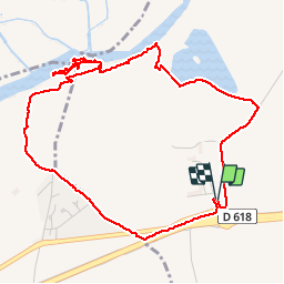
Trail Walking of 5.9 km to be discovered at Occitania, Pyrénées-Orientales, Villelongue-dels-Monts. This trail is proposed by jeff66.

Description

66 VILLELONGUE-DELS-MONTS, parking du lycée Alfred Sauvy, El Pla, Casot del Pastre, Lac, traverser le Correc de les Anglades, longer digue le long du Tech, berges, le Tech, station d'épuration, le moulin de Breuil, les Agouillous, Camp del Vern, mas Parada, chemin des vignes, itinéraire partagé le long de la RD618

Elevation profile

Positioning

Country:
France
Region :
Occitania
Department/Province :
Pyrénées-Orientales
Municipality :
Villelongue-dels-Monts
Location:
Unknown
Start:(UTM)
491227 ; 4710091 (31T) N.


Close
My subscriptions