


66 ARLES SUR TECH, de la fontaine des buis a Santa Creu, par le mas del Guardia, belvédère, grotte et oratoire

jeff66
User
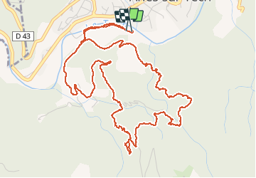

Length
8.1 km

Max alt
619 m

Uphill gradient
421 m
Km-Effort
13.7 km

Min alt
284 m

Downhill gradient
423 m
Boucle
Yes
Creation date :
2016-04-08 00:00:00.0
Updated on :
2016-04-08 00:00:00.0
3h03
Difficulty : Difficult

FREE GPS app for hiking
 SityTrail
IGN / Geographical institutes
SityTrail Plus
The world is yours!
About
Trail Walking of 8.1 km to be discovered at Occitania, Pyrénées-Orientales, Arles-sur-Tech. This trail is proposed by jeff66.
Description
66 ARLES SUR TECH, de la fontaine des buis a Santa Creu, par le mas del Guardia, belvédère, grotte et oratoire
Positioning
Country:
France
Region :
Occitania
Department/Province :
Pyrénées-Orientales
Municipality :
Arles-sur-Tech
Location:
Unknown
Start:(Dec)
Start:(UTM)
469493 ; 4700155 (31T) N.
Comments