


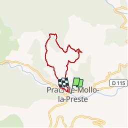
66 PRATS DE MOLLO, fort de Lagarde, col de Cavanelles, randonnée autour de PRATS

jeff66
User

Length
5.7 km

Max alt
988 m

Uphill gradient
269 m
Km-Effort
9.3 km

Min alt
723 m

Downhill gradient
269 m
Boucle
Yes
Creation date :
2016-04-11 00:00:00.0
Updated on :
2016-04-11 00:00:00.0
1h13
Difficulty : Medium

FREE GPS app for hiking
 SityTrail
IGN / Geographical institutes
SityTrail Plus
The world is yours!
About
Trail Walking of 5.7 km to be discovered at Occitania, Pyrénées-Orientales, Prats-de-Mollo-la-Preste. This trail is proposed by jeff66.
Description
66 PRATS DE MOLLO, fort de Lagarde, col de Cavanelles, randonnée autour de PRATS
Positioning
Country:
France
Region :
Occitania
Department/Province :
Pyrénées-Orientales
Municipality :
Prats-de-Mollo-la-Preste
Location:
Unknown
Start:(Dec)
Start:(UTM)
457281 ; 4694630 (31T) N.
Comments