Trail Other activity Pralognan-la-Vanoise - Tour des rochers du Génépy  et Pointe du Dard - Photo

Tour des rochers du Génépy et Pointe du Dard

 nadd73
nadd73

User

© OpenStreetMap contributors
Length
Length
12.3 km
Max alt
Max alt
3182 m
Uphill gradient
Uphill gradient
945 m
Km-Effort
Km-Effort  
25 km
Min alt
Min alt
2298 m
Downhill gradient
Downhill gradient
945 m
Boucle
Boucle
Yes
Creation date :
2016-04-22 00:00:00.0
Updated on :
2016-04-22 00:00:00.0

(0 Reviews)

Other activity
Other activity
5h26
Difficulty : Difficult

Scan this QR Code to open this trail in the SityTrail application

FREE GPS app for hiking

Logo SityTrail SityTrail

IGN / Geographical institutes

Download SityTrail from the App Store Download SityTrail from Google Play

Logo SityTrail SityTrail World

The world is yours!

Download SityTrail from the App Store Download SityTrail from Google Play Download SityTrail on Huawei AppGallery

About

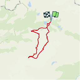
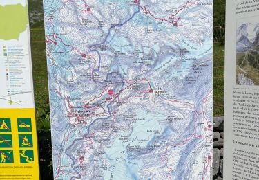
Trail Other activity of 12.3 km to be discovered at Auvergne-Rhône-Alpes, Savoy, Pralognan-la-Vanoise. This trail is proposed by nadd73.

Description

Du refuge  du col de la Vanoise descendre sous les rochers  du Genepy  au pt 2321m. (laisser les peaux  au début  ensuite les enlever )
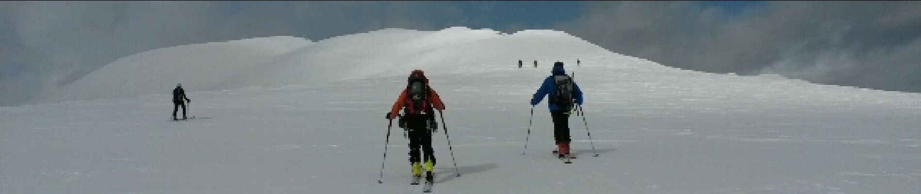
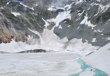
Monter sur le glacier de l'Arcelin  (attention séracs et raidillon). et direction sud vers le col du Dard pt 3206la pointe du Dard
Descente au refuge en passant sous les rochers du Genepy  (haut)

Elevation profile

Photos

Points of interest

Point of interest Pralognan-la-Vanoise - Point 2 - Photo
nadd73
PRALOGNAN-LA-VANOISE 

Positioning

Country:
France
Region :
Auvergne-Rhône-Alpes
Department/Province :
Savoy
Municipality :
Pralognan-la-Vanoise
Location:
Unknown
Start:(UTM)
327057 ; 5028885 (32T) N.

Trails nearby

Trail Walking Pralognan-la-Vanoise - Vanoise 2021 : refuge de la Vanoise au refuge de la Valette par les glacier et le dôme des Sonnailles (-07-18).ori - Photo
Walking
PatDev

Walking

Very difficult
(1)
Pralognan-la-Vanoise, Auvergne-Rhône-Alpes, Savoy, France
12.4 km | 26 km-effort
10h 10min
No
Trail Walking Pralognan-la-Vanoise - traversée des Fontanettes aux Prioux par le col du Grand marchet - Photo
Walking
GUIDE
amiral13

Walking

Difficult
Pralognan-la-Vanoise, Auvergne-Rhône-Alpes, Savoy, France
13.7 km | 30 km-effort
6h 51min
No
Trail Walking Pralognan-la-Vanoise - le lac de la patinoire - Photo
Walking
GUIDE
amiral13

Walking

Difficult
Pralognan-la-Vanoise, Auvergne-Rhône-Alpes, Savoy, France
11.3 km | 22 km-effort
5h 40min
Yes
Trail Walking Pralognan-la-Vanoise - 2022-06-25 Marche TGV Refuge Col de la Vanoise Refuge Arpont - Photo
Walking
GUIDE
holtzv

Walking

Medium
Pralognan-la-Vanoise, Auvergne-Rhône-Alpes, Savoy, France
15.5 km | 22 km-effort
5h 52min
No
Trail Walking Pralognan-la-Vanoise - 2022-06-24 Marche TGV Pralognan Refuge du Col de la Vanoise - Photo
Walking
GUIDE
holtzv

Walking

Medium
Pralognan-la-Vanoise, Auvergne-Rhône-Alpes, Savoy, France
7.1 km | 15.7 km-effort
2h 37min
No
Trail Walking Val-Cenis - Lacs des lozières, de la Roche Ferran et du Pelve - Photo
Walking
GUIDE
amiral13

Walking

Difficult
Val-Cenis, Auvergne-Rhône-Alpes, Savoy, France
14.6 km | 27 km-effort
6h 38min
Yes
Trail Walking Pralognan-la-Vanoise - Col de la Vanoise - Photo
Walking
albertivillarien

Walking

Easy
(2)
Pralognan-la-Vanoise, Auvergne-Rhône-Alpes, Savoy, France
9.8 km | 16.7 km-effort
3h 29min
Yes
Trail Walking Pralognan-la-Vanoise - tour pic de la vanoise - Photo
Walking
herve720

Walking

Very easy
(1)
Pralognan-la-Vanoise, Auvergne-Rhône-Alpes, Savoy, France
17.2 km | 29 km-effort
6h 16min
Yes
Trail Walking Pralognan-la-Vanoise - Le Col de la Vannoise - Photo
Walking
dautriche

Walking

Difficult
Pralognan-la-Vanoise, Auvergne-Rhône-Alpes, Savoy, France
13 km | 25 km-effort
5h 35min
Yes


Close
My subscriptions