


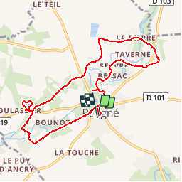
Périgné_9,3km

olaze
User

Length
9.3 km

Max alt
84 m

Uphill gradient
86 m
Km-Effort
10.4 km

Min alt
46 m

Downhill gradient
89 m
Boucle
Yes
Creation date :
2016-05-18 00:00:00.0
Updated on :
2016-05-18 00:00:00.0
2h28
Difficulty : Easy

FREE GPS app for hiking
 SityTrail
IGN / Geographical institutes
SityTrail Plus
The world is yours!
About
Trail Walking of 9.3 km to be discovered at New Aquitaine, Deux-Sèvres, Périgné. This trail is proposed by olaze.
Description
Belle randonnée, agréable, bons chemins tout temps. Mai 2016.
Photos


Positioning
Country:
France
Region :
New Aquitaine
Department/Province :
Deux-Sèvres
Municipality :
Périgné
Location:
Unknown
Start:(Dec)
Start:(UTM)
711778 ; 5118439 (30T) N.
Comments