Trail Other activity Villar-Saint-Pancrace - Pas de la casse de l'Ase.  crête de serre chapelle.  Rocher Roux - Photo

Pas de la casse de l'Ase. crête de serre chapelle. Rocher Roux

 nadd73
nadd73

User

© OpenStreetMap contributors
Length
Length
14.6 km
Max alt
Max alt
2694 m
Uphill gradient
Uphill gradient
1412 m
Km-Effort
Km-Effort  
33 km
Min alt
Min alt
2059 m
Downhill gradient
Downhill gradient
1411 m
Boucle
Boucle
Yes
Creation date :
2016-06-07 00:00:00.0
Updated on :
2016-06-07 00:00:00.0

(0 Reviews)

Other activity
Other activity
7h32
Difficulty : Medium

Scan this QR Code to open this trail in the SityTrail application

FREE GPS app for hiking

Logo SityTrail SityTrail

IGN / Geographical institutes

Download SityTrail from the App Store Download SityTrail from Google Play

Logo SityTrail SityTrail World

The world is yours!

Download SityTrail from the App Store Download SityTrail from Google Play Download SityTrail on Huawei AppGallery

About

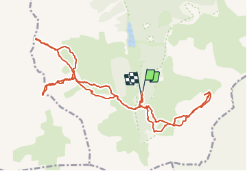
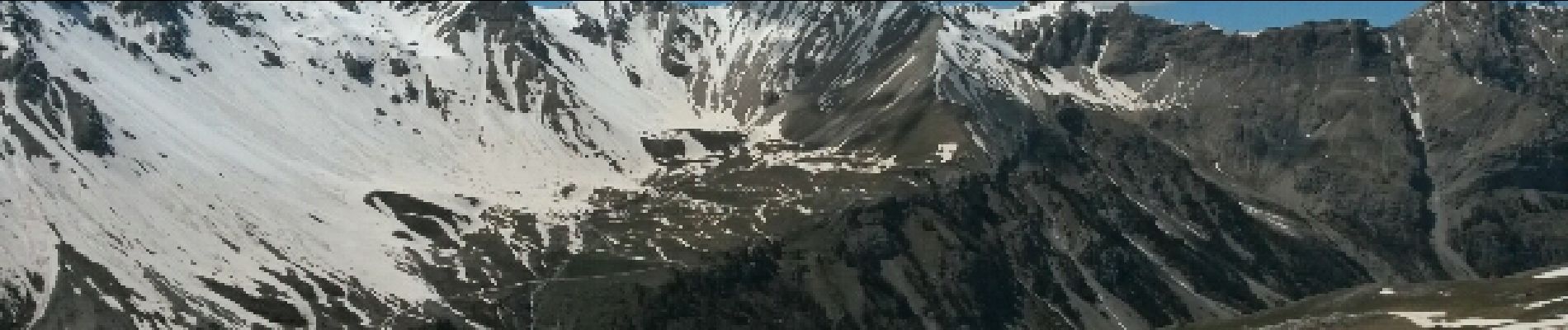
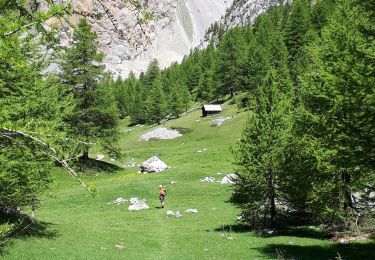
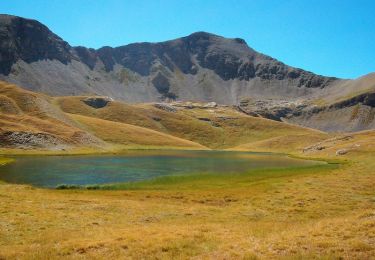
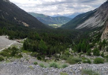
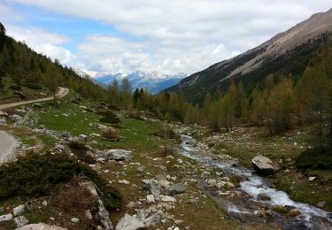
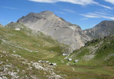
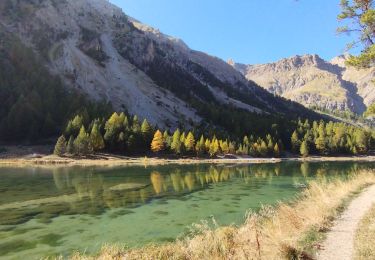
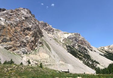
Trail Other activity of 14.6 km to be discovered at Provence-Alpes-Côte d'Azur, Hautes-Alpes, Villar-Saint-Pancrace. This trail is proposed by nadd73.

Description

Villar  st Pancrase les Ayes lac dOrceyrette se garer au plus haut sur la route en direction des chalets  d'Orceyrette et suivre  l'itinéraire

Elevation profile

Photos

Positioning

Country:
France
Region :
Provence-Alpes-Côte d'Azur
Department/Province :
Hautes-Alpes
Municipality :
Villar-Saint-Pancrace
Location:
Unknown
Start:(UTM)
314758 ; 4964422 (32T) N.

Trails nearby

Trail Walking Arvieux - col de Néal par les chalets de Clapeyto - Photo
Walking
GUIDE
amiral13

Walking

Easy
(2)
Arvieux, Provence-Alpes-Côte d'Azur, Hautes-Alpes, France
11.7 km | 19.7 km-effort
5h 34min
Yes
Trail Via ferrata Arvieux - via Ferrara combe la roche et pratique premier  - Photo
Via ferrata
bellouelo46

Via ferrata

Easy
(1)
Arvieux, Provence-Alpes-Côte d'Azur, Hautes-Alpes, France
1.6 km | 7.7 km-effort
2h 16min
No
Trail Walking La Roche-de-Rame - Lac de l'Ascension - La Roche de Rame - Photo
Walking
tracegps

Walking

Difficult
(1)
La Roche-de-Rame, Provence-Alpes-Côte d'Azur, Hautes-Alpes, France
14.3 km | 25 km-effort
4h 30min
Yes
Trail Walking Arvieux - Clapeyto - Photo
Walking
CAUBERTGENEVIEVE

Walking

Easy
Arvieux, Provence-Alpes-Côte d'Azur, Hautes-Alpes, France
12 km | 20 km-effort
4h 35min
Yes
Trail Walking Villar-Saint-Pancrace - Briançonnais Chalets des Ayes - Photo
Walking
Orcal37

Walking

Medium
Villar-Saint-Pancrace, Provence-Alpes-Côte d'Azur, Hautes-Alpes, France
7.1 km | 12 km-effort
2h 15min
Yes
Trail Mountain bike Arvieux - Brunissard La roche de rame - Photo
Mountain bike
pierrot.duc

Mountain bike

Very difficult
Arvieux, Provence-Alpes-Côte d'Azur, Hautes-Alpes, France
24 km | 41 km-effort
3h 30min
No
Trail Walking Arvieux - Les chalets de Clapeyto - Lac Néal - Photo
Walking
tracegps

Walking

Difficult
Arvieux, Provence-Alpes-Côte d'Azur, Hautes-Alpes, France
20 km | 36 km-effort
7h 0min
Yes
Trail Walking Villar-Saint-Pancrace - crête de Vallouret - Photo
Walking
orsel

Walking

Medium
Villar-Saint-Pancrace, Provence-Alpes-Côte d'Azur, Hautes-Alpes, France
11.5 km | 22 km-effort
6h 9min
Yes
Trail Walking Arvieux - Qu’eurasien 15-06-22 - Photo
Walking
fredeic

Walking

Difficult
Arvieux, Provence-Alpes-Côte d'Azur, Hautes-Alpes, France
8.5 km | 15.3 km-effort
4h 25min
Yes


Close
My subscriptions