


Adarza depuis le col d'Aharza

martin.mondeville
User

Length
10 km

Max alt
1239 m

Uphill gradient
613 m
Km-Effort
18.1 km

Min alt
719 m

Downhill gradient
613 m
Boucle
Yes
Creation date :
2016-06-08 00:00:00.0
Updated on :
2016-06-08 00:00:00.0
4h07
Difficulty : Medium

FREE GPS app for hiking
 SityTrail
IGN / Geographical institutes
SityTrail Plus
The world is yours!
About
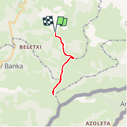
Trail Walking of 10 km to be discovered at New Aquitaine, Pyrénées-Atlantiques, Saint-Étienne-de-Baïgorry. This trail is proposed by martin.mondeville.
Positioning
Country:
France
Region :
New Aquitaine
Department/Province :
Pyrénées-Atlantiques
Municipality :
Saint-Étienne-de-Baïgorry
Location:
Unknown
Start:(Dec)
Start:(UTM)
635360 ; 4778245 (30T) N.
Comments