![](/images/other/stat-length.png)
![Trail Walking Sainte-Croix - Col des Etroits - L'Auberson 28.06.16 - Photo](https://media.geolcdn.com/t/1900/400/ext.pjpeg?maxdim=2&url=https%3A%2F%2Fservices.sitytrail.com%2FGeolivesWS%2FDownloadMedia.ashx%3FTrailID%3D590095%26Media%3Dfix__20160628113015.jpg)
Col des Etroits - L'Auberson 28.06.16
duamerg
User
![Length](/images/other/stat-length.png)
Length
13.8 km
![Max alt](https://static1.geolcdn.com/siteimages/upload/files/1508320355ic_sort_altitude_max_24dp.png)
Max alt
1193 m
![Uphill gradient](https://static1.geolcdn.com/siteimages/upload/files/1508320355ic_sort_den_pos_24dp.png)
Uphill gradient
380 m
![Km-Effort](/images/other/stat-length.png)
Km-Effort
18.8 km
![Min alt](https://static1.geolcdn.com/siteimages/upload/files/1508320355ic_sort_altitude_min_24dp.png)
Min alt
1027 m
![Downhill gradient](https://static1.geolcdn.com/siteimages/upload/files/1508320355ic_sort_den_neg_24dp.png)
Downhill gradient
370 m
![Boucle](https://static1.geolcdn.com/siteimages/upload/files/16400158638029165_repeat_loop_refresh_sync_direction_icon.png)
Boucle
Yes
Creation date :
2016-06-29 00:00:00.0
Updated on :
2020-01-30 13:56:44.835
![Walking](https://static1.geolcdn.com/sitytour/trail-icons/101.png)
4h12
Difficulty : Easy
![Scan this QR Code to open this trail in the SityTrail application](https://capi.geolives.com/qq0zvz2zws4bq2lad0pu/sitytour/trails/590095/qr.png?size=200)
FREE GPS app for hiking
About
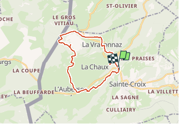
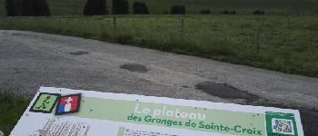
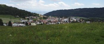
Trail Walking of 13.8 km to be discovered at Vaud, District du Jura-Nord vaudois, Sainte-Croix. This trail is proposed by duamerg.
Description
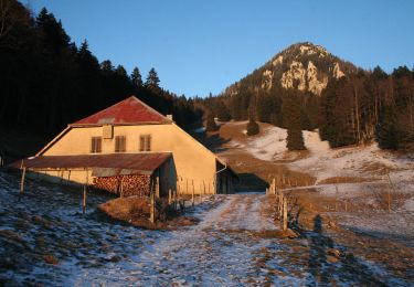
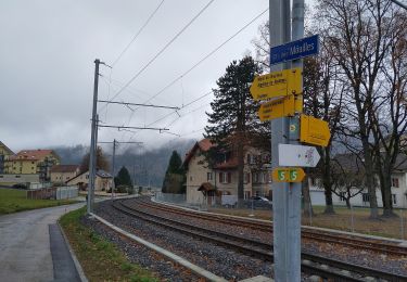
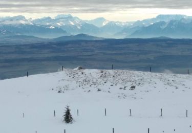
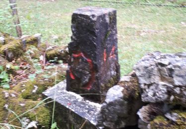
Laisser la voiture au col des Etroits. Suivre les panneaux indicateurs qui vous méneront à La Vraconnaz - les Rochettes - La tourbière - Granges Jaccard -L'Auberson.
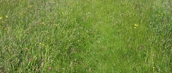
Jolie ballade sans difficultés faisant connaître cette belle partie du jura.
Positioning
Country:
Switzerland
Region :
Vaud
Department/Province :
District du Jura-Nord vaudois
Municipality :
Sainte-Croix
Location:
Unknown
Start:(Dec)
Start:(UTM)
308891 ; 5189409 (32T) N.
Comments
Trails nearby
![Trail On foot La Côte-aux-Fées - La Côte-aux-Fées - Buttes - Photo](https://media.geolcdn.com/t/375/260/ext.jpg?maxdim=2&url=https%3A%2F%2Fmedia.geolcdn.com%2Ff%2F4ddaa482-5cf5-46b7-b784-db7dcb3959dd.jpeg)
![On foot On foot](https://static1.geolcdn.com/sitytour/trail-icons/100.png)
La Côte-aux-Fées - Buttes
On foot
Easy
La Côte-aux-Fées,
Neuchâtel,
Unknown,
Switzerland
![](/images/other/stat-length.png)
6.7 km | 8.5 km-effort
1h 55min
![](https://static1.geolcdn.com/siteimages/upload/files/16400158638029165_repeat_loop_refresh_sync_direction_icon.png)
No
![Trail On foot Sainte-Croix - La Gittaz-Col de l'Aigullon - Photo](https://media.geolcdn.com/t/375/260/ext.jpg?maxdim=2&url=https%3A%2F%2Fmedia.geolcdn.com%2Ff%2F6946b4e0-6068-4cfa-bbe6-24c55651ec09.jpeg)
![On foot On foot](https://static1.geolcdn.com/sitytour/trail-icons/100.png)
La Gittaz-Col de l'Aigullon
On foot
Easy
Sainte-Croix,
Vaud,
District du Jura-Nord vaudois,
Switzerland
![](/images/other/stat-length.png)
4.1 km | 6.4 km-effort
1h 26min
![](https://static1.geolcdn.com/siteimages/upload/files/16400158638029165_repeat_loop_refresh_sync_direction_icon.png)
No
![Trail On foot Sainte-Croix - Sainte Croix-La Gittaz - Photo](https://media.geolcdn.com/t/375/260/ext.jpg?maxdim=2&url=https%3A%2F%2Fmedia.geolcdn.com%2Ff%2F7c0dcc60-9777-42cd-b5f3-05d60f03159f.jpeg)
![On foot On foot](https://static1.geolcdn.com/sitytour/trail-icons/100.png)
Sainte Croix-La Gittaz
On foot
Easy
Sainte-Croix,
Vaud,
District du Jura-Nord vaudois,
Switzerland
![](/images/other/stat-length.png)
5.7 km | 8.3 km-effort
1h 53min
![](https://static1.geolcdn.com/siteimages/upload/files/16400158638029165_repeat_loop_refresh_sync_direction_icon.png)
No
![Trail On foot Sainte-Croix - Chemin de la Gare - Photo](https://media.geolcdn.com/t/375/260/ext.jpg?maxdim=2&url=https%3A%2F%2Fmedia.geolcdn.com%2Ff%2F1c01c3b8-df2a-4423-9b92-ab96556853c0.jpeg)
![On foot On foot](https://static1.geolcdn.com/sitytour/trail-icons/100.png)
Chemin de la Gare
On foot
Easy
Sainte-Croix,
Vaud,
District du Jura-Nord vaudois,
Switzerland
![](/images/other/stat-length.png)
6.5 km | 8.6 km-effort
1h 57min
![](https://static1.geolcdn.com/siteimages/upload/files/16400158638029165_repeat_loop_refresh_sync_direction_icon.png)
No
![Trail On foot Les Fourgs - Le Sentier des Bornes - Photo](https://media.geolcdn.com/t/375/260/ext.jpg?maxdim=2&url=https%3A%2F%2Fmedia.geolcdn.com%2Ff%2F4777e0b5-35d9-430b-b18b-01a7bbd1a8dc.jpeg)
![On foot On foot](https://static1.geolcdn.com/sitytour/trail-icons/100.png)
Le Sentier des Bornes
On foot
Easy
Les Fourgs,
Bourgogne-Franche-Comté,
Doubs,
France
![](/images/other/stat-length.png)
6.4 km | 8 km-effort
1h 48min
![](https://static1.geolcdn.com/siteimages/upload/files/16400158638029165_repeat_loop_refresh_sync_direction_icon.png)
No
![Trail Walking Sainte-Croix - le Chasseron par les avattes - Photo](https://media.geolcdn.com/t/375/260/ext.jpg?maxdim=2&url=https%3A%2F%2Fservices.sitytrail.com%2FGeolivesWS%2FDownloadMedia.ashx%3FTrailID%3D966325%26Media%3Dfix__20180507162134.jpg)
![Walking Walking](https://static1.geolcdn.com/sitytour/trail-icons/101.png)
le Chasseron par les avattes
Walking
Medium
Sainte-Croix,
Vaud,
District du Jura-Nord vaudois,
Switzerland
![](/images/other/stat-length.png)
13.3 km | 20 km-effort
4h 18min
![](https://static1.geolcdn.com/siteimages/upload/files/16400158638029165_repeat_loop_refresh_sync_direction_icon.png)
Yes
![Trail Snowshoes Sainte-Croix - Col des Etroits Le Chasseron CAF - Photo](https://media.geolcdn.com/t/375/260/ext.jpg?maxdim=2&url=https%3A%2F%2Fmedia.geolcdn.com%2Ff%2F73c05fda-b10e-4eb7-8c51-21af8620a72d.jpg)
![Snowshoes Snowshoes](https://static1.geolcdn.com/sitytour/trail-icons/504.png)
Col des Etroits Le Chasseron CAF
Snowshoes
Difficult
Sainte-Croix,
Vaud,
District du Jura-Nord vaudois,
Switzerland
![](/images/other/stat-length.png)
12.2 km | 19.9 km-effort
Unknown
![](https://static1.geolcdn.com/siteimages/upload/files/16400158638029165_repeat_loop_refresh_sync_direction_icon.png)
Yes
![Trail Walking Sainte-Croix - Sentier des bornes sud - Photo](https://media.geolcdn.com/t/375/260/ext.jpg?maxdim=2&url=https%3A%2F%2Fmedia.geolcdn.com%2Ff%2Ff42e42f4-9b7b-4ade-8d19-3d5cc767500a.jpg)
![Walking Walking](https://static1.geolcdn.com/sitytour/trail-icons/101.png)
Sentier des bornes sud
Walking
Very easy
Sainte-Croix,
Vaud,
District du Jura-Nord vaudois,
Switzerland
![](/images/other/stat-length.png)
6.7 km | 8.7 km-effort
2h 46min
![](https://static1.geolcdn.com/siteimages/upload/files/16400158638029165_repeat_loop_refresh_sync_direction_icon.png)
Yes
![Trail Other activity Sainte-Croix - Les Montagnes de Baulnes - Photo](https://media.geolcdn.com/t/375/260/ext.jpg?maxdim=2&url=https%3A%2F%2Fservices.sitytrail.com%2FGeolivesWS%2FDownloadMedia.ashx%3FTrailID%3D559592%26Media%3Dfix__20160311115351.jpg)
![Other activity Other activity](https://static1.geolcdn.com/sitytour/trail-icons/900.png)
Les Montagnes de Baulnes
Other activity
Very easy
Sainte-Croix,
Vaud,
District du Jura-Nord vaudois,
Switzerland
![](/images/other/stat-length.png)
5.5 km | 9.2 km-effort
1h 44min
![](https://static1.geolcdn.com/siteimages/upload/files/16400158638029165_repeat_loop_refresh_sync_direction_icon.png)
No
Je vous donnerai après l avoir essayé