Trail Walking Châtel-Montagne - Chatel Montagne - centrale hydroelectrique - Photo

Chatel Montagne - centrale hydroelectrique

 coco03
coco03

User

© OpenStreetMap contributors
Length
Length
11.9 km
Max alt
Max alt
538 m
Uphill gradient
Uphill gradient
387 m
Km-Effort
Km-Effort  
17.1 km
Min alt
Min alt
343 m
Downhill gradient
Downhill gradient
389 m
Boucle
Boucle
Yes
Creation date :
2016-07-17 00:00:00.0
Updated on :
2016-07-17 00:00:00.0

(0 Reviews)

Walking
Walking
3h40
Difficulty : Easy

Scan this QR Code to open this trail in the SityTrail application

FREE GPS app for hiking

Logo SityTrail SityTrail

IGN / Geographical institutes

Download SityTrail from the App Store Download SityTrail from Google Play

Logo SityTrail SityTrail World

The world is yours!

Download SityTrail from the App Store Download SityTrail from Google Play Download SityTrail on Huawei AppGallery

About

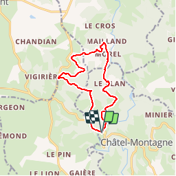
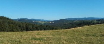
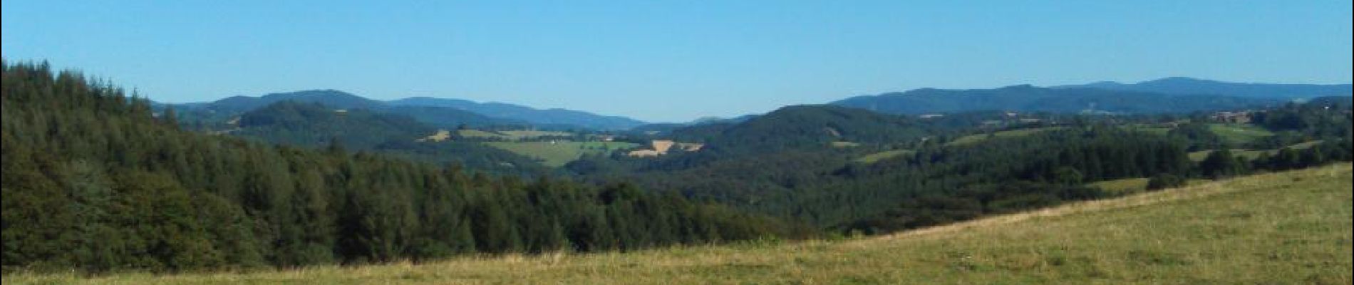
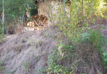
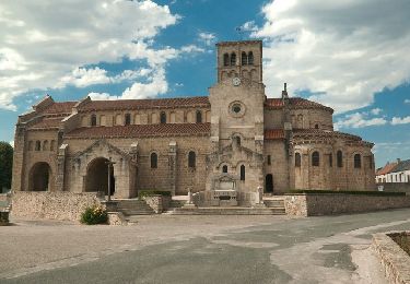
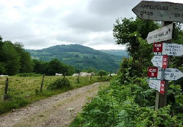
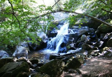
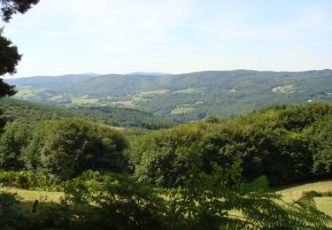
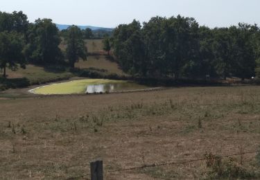
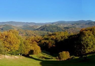
Trail Walking of 11.9 km to be discovered at Auvergne-Rhône-Alpes, Allier, Châtel-Montagne. This trail is proposed by coco03.

Elevation profile

Photos

Points of interest

Point of interest Nizerolles - poi1 - Photo
coco03
NIZEROLLES 

Positioning

Country:
France
Region :
Auvergne-Rhône-Alpes
Department/Province :
Allier
Municipality :
Châtel-Montagne
Location:
Unknown
Start:(UTM)
551418 ; 5107254 (31T) N.

Trails nearby

Trail Running Châtel-Montagne - jour 7 CAP Jeanot - Photo
Running
jeannat

Running

Very easy
Châtel-Montagne, Auvergne-Rhône-Alpes, Allier, France
33 km | 43 km-effort
4h 29min
No
Trail Walking Châtel-Montagne - Charguéraud a La Croix Bruyère  - Photo
Walking
NANE51

Walking

Easy
Châtel-Montagne, Auvergne-Rhône-Alpes, Allier, France
12.2 km | 16.9 km-effort
3h 9min
No
Trail Walking Châtel-Montagne - Le Puy du Roc - Châtel-Montagne - Photo
Walking
tracegps

Walking

Medium
Châtel-Montagne, Auvergne-Rhône-Alpes, Allier, France
10.2 km | 15.3 km-effort
3h 0min
Yes
Trail Mountain bike Arfeuilles - La vallée du Barbenan (VTT-2011) - Arfeuilles - Photo
Mountain bike
tracegps

Mountain bike

Very difficult
Arfeuilles, Auvergne-Rhône-Alpes, Allier, France
53 km | 77 km-effort
5h 0min
Yes
Trail Walking Arfeuilles - La Pisserote - Arfeuilles - Photo
Walking
tracegps

Walking

Difficult
(1)
Arfeuilles, Auvergne-Rhône-Alpes, Allier, France
14.9 km | 22 km-effort
4h 0min
No
Trail Walking Le Mayet-de-Montagne - Saint Clément - Photo
Walking
tracegps

Walking

Difficult
Le Mayet-de-Montagne, Auvergne-Rhône-Alpes, Allier, France
15.9 km | 23 km-effort
3h 30min
Yes
Trail Hybrid bike Châtel-Montagne - jour 7 - Photo
Hybrid bike
nathbab

Hybrid bike

Very easy
Châtel-Montagne, Auvergne-Rhône-Alpes, Allier, France
27 km | 32 km-effort
2h 6min
No
Trail Walking Châtel-Montagne - Balade autour du Mont Aigu - Le Moulin Chatel - Photo
Walking
tracegps

Walking

Medium
Châtel-Montagne, Auvergne-Rhône-Alpes, Allier, France
10.4 km | 14.1 km-effort
2h 30min
Yes
Trail Walking Châtel-Montagne - Autour du mont Aigu -  Châtel-Montagne - Photo
Walking
tracegps

Walking

Difficult
Châtel-Montagne, Auvergne-Rhône-Alpes, Allier, France
14 km | 19.9 km-effort
4h 0min
Yes


Close
My subscriptions