


Cublac-Loubignac

houbart
User
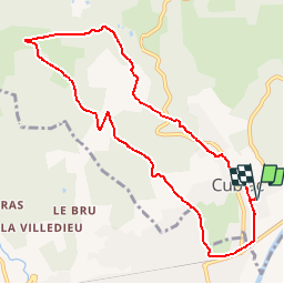

Length
9.7 km

Max alt
309 m

Uphill gradient
268 m
Km-Effort
13.2 km

Min alt
86 m

Downhill gradient
268 m
Boucle
Yes
Creation date :
2019-03-28 15:47:20.23
Updated on :
2019-03-28 15:47:20.278
2h48
Difficulty : Unknown

FREE GPS app for hiking
 SityTrail
IGN / Geographical institutes
SityTrail Plus
The world is yours!
About
Trail Walking of 9.7 km to be discovered at New Aquitaine, Corrèze, Cublac. This trail is proposed by houbart.
Positioning
Country:
France
Region :
New Aquitaine
Department/Province :
Corrèze
Municipality :
Cublac
Location:
Unknown
Start:(Dec)
Start:(UTM)
367036 ; 5000188 (31T) N.
Comments