14.5 km | 26 km-effort
Breil-sur-Roya - Sentier Valéen Nord - 2016 06 26
Orcal37
User
Length
5.5 km
Max alt
385 m
Uphill gradient
183 m
Km-Effort
7.9 km
Min alt
283 m
Downhill gradient
183 m
Boucle
Yes
Creation date :
2016-07-15 00:00:00.0
Updated on :
2021-09-16 15:18:37.679
1h25
Difficulty : Very easy
FREE GPS app for hiking
About
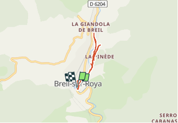
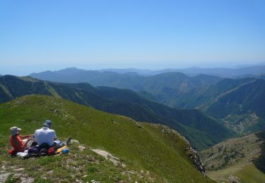
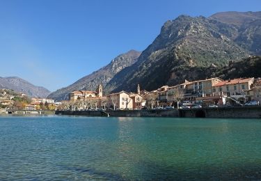
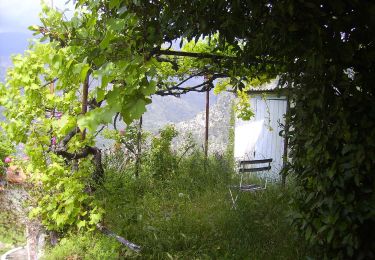
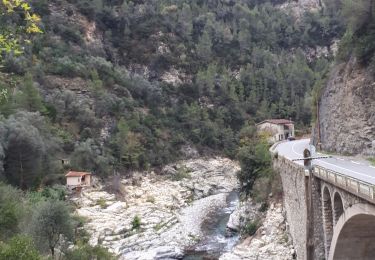
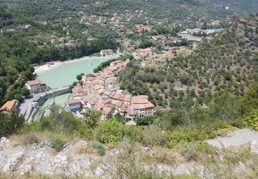
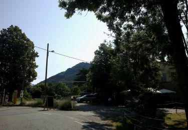
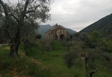
Trail Walking of 5.5 km to be discovered at Provence-Alpes-Côte d'Azur, Maritime Alps, Breil-sur-Roya. This trail is proposed by Orcal37.
Description
Breil-sur-Roya - Sentier Valéen Nord - 2016 06 26
Positioning
Country:
France
Region :
Provence-Alpes-Côte d'Azur
Department/Province :
Maritime Alps
Municipality :
Breil-sur-Roya
Location:
Unknown
Start:(Dec)
Start:(UTM)
380718 ; 4865894 (32T) N.
Comments
Trails nearby
Circuit de la Déa
On foot
Medium
Breil-sur-Roya,
Provence-Alpes-Côte d'Azur,
Maritime Alps,
France
6h 1min
Yes
Circuit de la Carleva
On foot
Medium
Breil-sur-Roya,
Provence-Alpes-Côte d'Azur,
Maritime Alps,
France
11.6 km | 22 km-effort
4h 56min
Yes
Circuit de Libre
On foot
Easy
Breil-sur-Roya,
Provence-Alpes-Côte d'Azur,
Maritime Alps,
France
7 km | 14 km-effort
3h 10min
Yes
Hameau de Piène Haute
On foot
Easy
Breil-sur-Roya,
Provence-Alpes-Côte d'Azur,
Maritime Alps,
France
6.1 km | 12 km-effort
2h 42min
Yes
Circuit Libre , Breil sur Roya
Walking
Medium
Breil-sur-Roya,
Provence-Alpes-Côte d'Azur,
Maritime Alps,
France
10.6 km | 21 km-effort
4h 5min
Yes
Breuil sur Roya. col de Brouis. Tour de la cime du Bosc.
Walking
Medium
Breil-sur-Roya,
Provence-Alpes-Côte d'Azur,
Maritime Alps,
France
15 km | 25 km-effort
8h 0min
Yes
Mont Gros
On foot
Easy
Breil-sur-Roya,
Provence-Alpes-Côte d'Azur,
Maritime Alps,
France
7.4 km | 12.7 km-effort
2h 52min
Yes
col d annon
Walking
Difficult
Breil-sur-Roya,
Provence-Alpes-Côte d'Azur,
Maritime Alps,
France
19.2 km | 33 km-effort
6h 30min
No
Breil-sur-Roya - Notre-Dame du Mont - 2016 06 21
Walking
Easy
Breil-sur-Roya,
Provence-Alpes-Côte d'Azur,
Maritime Alps,
France
4.6 km | 6.8 km-effort
1h 45min
Yes