


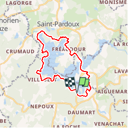
Tour du Lac de St Pardoux - 14,6 km - 4h00

Bastet
User


4h00
Difficulty : Easy

FREE GPS app for hiking
 SityTrail
IGN / Geographical institutes
SityTrail Plus
The world is yours!
About
Trail Walking of 14.4 km to be discovered at New Aquitaine, Haute-Vienne, Compreignac. This trail is proposed by Bastet.
Description
Ce tour du Lac de St Pardoux vous fera découvrir de magnifiques points de vues. Souvent à l'ombre du dense couvert forestier, les chemins et sentiers parcourent les abords au plus près de l'eau. De nombreuses petites plages sont propices aux pauses et aux baignades dans une eau chaude en été.
Positioning
Comments