


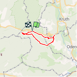
Stroessle-Chemin des Alliés-Langenbach-Chapelle St Nicolas-Werschmatt et retour parking

patrickbeyrath
User

Length
7.8 km

Max alt
928 m

Uphill gradient
364 m
Km-Effort
12.7 km

Min alt
581 m

Downhill gradient
363 m
Boucle
Yes
Creation date :
2018-10-13 05:52:23.869
Updated on :
2018-10-13 05:52:23.875
2h48
Difficulty : Medium

FREE GPS app for hiking
 SityTrail
IGN / Geographical institutes
SityTrail Plus
The world is yours!
About
Trail Walking of 7.8 km to be discovered at Grand Est, Haut-Rhin, Fellering. This trail is proposed by patrickbeyrath.
Positioning
Country:
France
Region :
Grand Est
Department/Province :
Haut-Rhin
Municipality :
Fellering
Location:
Unknown
Start:(Dec)
Start:(UTM)
345351 ; 5309707 (32T) N.
Comments