


Mont grêle

grattounette
User
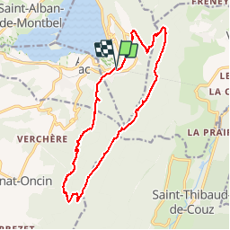

Length
17.8 km

Max alt
1433 m

Uphill gradient
1085 m
Km-Effort
32 km

Min alt
406 m

Downhill gradient
1083 m
Boucle
Yes
Creation date :
2016-08-10 00:00:00.0
Updated on :
2016-08-10 00:00:00.0
8h05
Difficulty : Difficult

FREE GPS app for hiking
 SityTrail
IGN / Geographical institutes
SityTrail Plus
The world is yours!
About
Trail Walking of 17.8 km to be discovered at Auvergne-Rhône-Alpes, Savoy, Aiguebelette-le-Lac. This trail is proposed by grattounette.
Description
Aiguillette le lac, la rousse, Mont grêle, col St Michel, les Cambets
Positioning
Country:
France
Region :
Auvergne-Rhône-Alpes
Department/Province :
Savoy
Municipality :
Aiguebelette-le-Lac
Location:
Unknown
Start:(Dec)
Start:(UTM)
719800 ; 5046507 (31T) N.
Comments
Magnifique parcours et points de vue !