Trail Walking Rougemont-le-Château - BAERENKOPF - Photo
 tiene
tiene

User

© OpenStreetMap contributors
Length
Length
23 km
Max alt
Max alt
1070 m
Uphill gradient
Uphill gradient
953 m
Km-Effort
Km-Effort  
36 km
Min alt
Min alt
539 m
Downhill gradient
Downhill gradient
950 m
Boucle
Boucle
Yes
Creation date :
2016-08-13 00:00:00.0
Updated on :
2016-08-13 00:00:00.0

(0 Reviews)

Walking
Walking
7h27
Difficulty : Medium

Scan this QR Code to open this trail in the SityTrail application

FREE GPS app for hiking

Logo SityTrail SityTrail

IGN / Geographical institutes

Download SityTrail from the App Store Download SityTrail from Google Play

Logo SityTrail SityTrail World

The world is yours!

Download SityTrail from the App Store Download SityTrail from Google Play Download SityTrail on Huawei AppGallery

About

Trail Walking of 23 km to be discovered at Bourgogne-Franche-Comté, Territoire-de-Belfort, Rougemont-le-Château. This trail is proposed by tiene.

Description

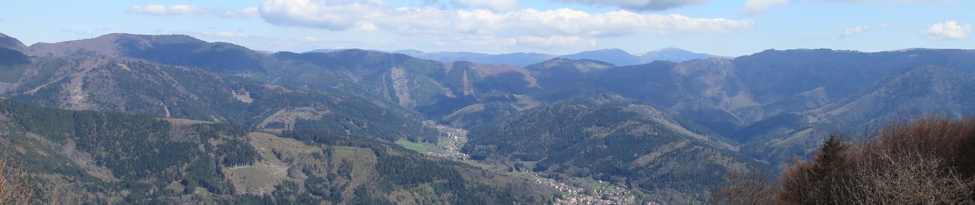
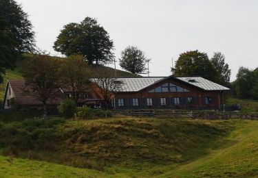
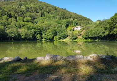
C’est un parcours magnifique avec des superbes vues sur le Ballon,le Grand Ballon,la vallée de "La Doller" depuis le sentier panoramique.
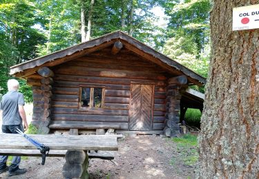
Petit conseil:Partir de St-Nicolas vers 9h pour apprécier le casse croute vers l'abri du "Sommerseite"

Elevation profile

Photos

Positioning

Country:
France
Region :
Bourgogne-Franche-Comté
Department/Province :
Territoire-de-Belfort
Municipality :
Rougemont-le-Château
Location:
Unknown
Start:(UTM)
345461 ; 5290304 (32T) N.

Trails nearby

Trail Walking Masevaux-Niederbruck - Masevaux - Rossberg par le belvédère du Fuchsfelsen - Photo
Walking
Bart2015

Walking

Medium
(1)
Masevaux-Niederbruck, Grand Est, Haut-Rhin, France
19.9 km | 34 km-effort
4h 44min
Yes
Trail Walking Kirchberg - 2022-07-15 Marche Refuge Baerenkopf Auberge Gazon Vert - Photo
Walking
GUIDE
holtzv

Walking

Very difficult
Kirchberg, Grand Est, Haut-Rhin, France
23 km | 38 km-effort
8h 21min
No
Trail Walking Masevaux-Niederbruck - Rando CLAS du 25/04/2024 - Photo
Walking
boubou68

Walking

Very difficult
Masevaux-Niederbruck, Grand Est, Haut-Rhin, France
17 km | 28 km-effort
4h 24min
Yes
Trail Walking Kirchberg - Sommerseitkids - Photo
Walking
helmut68

Walking

Medium
Kirchberg, Grand Est, Haut-Rhin, France
6.6 km | 10.2 km-effort
2h 2min
No
Trail Walking Masevaux-Niederbruck - Les Dames nobles de Masevaux  - Photo
Walking
helmut68

Walking

Medium
Masevaux-Niederbruck, Grand Est, Haut-Rhin, France
12.3 km | 17.6 km-effort
3h 0min
Yes
Trail Walking Kirchberg - Lachtelweiher - fermes auberges - Photo
Walking
Bart2015

Walking

Medium
Kirchberg, Grand Est, Haut-Rhin, France
13.9 km | 21 km-effort
3h 5min
Yes
Trail Walking Sickert - Départ de Sickert dir Sattelboden 26/08/2021) - Photo
Walking
Richard68500

Walking

Difficult
Sickert, Grand Est, Haut-Rhin, France
16.4 km | 26 km-effort
4h 52min
Yes
Trail Walking Masevaux-Niederbruck - niederbruck lochberg circuit - Photo
Walking
GUIDE
stempfel52

Walking

Very difficult
Masevaux-Niederbruck, Grand Est, Haut-Rhin, France
15.1 km | 24 km-effort
3h 52min
Yes
Trail Walking Kirchberg - 2020-06-24 DW35 Au-dessus du lac Lachtelweiher - Photo
Walking
ABICHE

Walking

Medium
Kirchberg, Grand Est, Haut-Rhin, France
11.9 km | 18.8 km-effort
4h 59min
Yes


Close
My subscriptions