


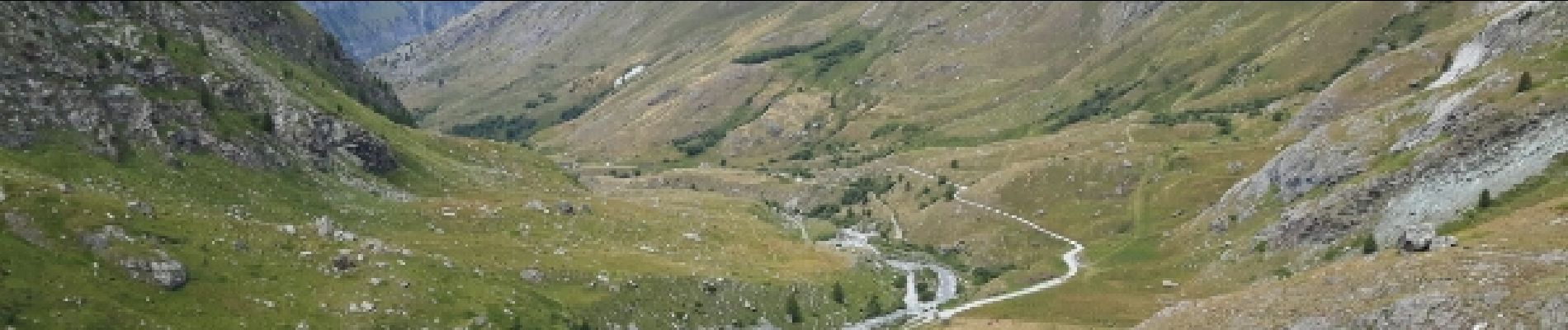
refuge d'Averole

amiral13
User GUIDE
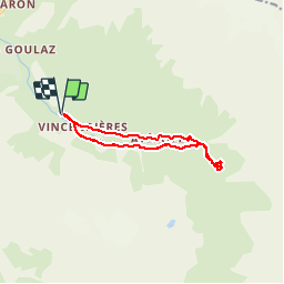

Length
11.1 km

Max alt
2211 m

Uphill gradient
424 m
Km-Effort
16.7 km

Min alt
1813 m

Downhill gradient
424 m
Boucle
Yes
Creation date :
2016-09-11 00:00:00.0
Updated on :
2016-09-11 00:00:00.0
4h37
Difficulty : Easy

FREE GPS app for hiking
 SityTrail
IGN / Geographical institutes
SityTrail Plus
The world is yours!
About
Trail Walking of 11.1 km to be discovered at Auvergne-Rhône-Alpes, Savoy, Bessans. This trail is proposed by amiral13.
Description
Balade familliale
Photos


Positioning
Country:
France
Region :
Auvergne-Rhône-Alpes
Department/Province :
Savoy
Municipality :
Bessans
Location:
Unknown
Start:(Dec)
Start:(UTM)
345973 ; 5019157 (32T) N.
Comments