


Le tour du Mont roup

amiral13
User GUIDE
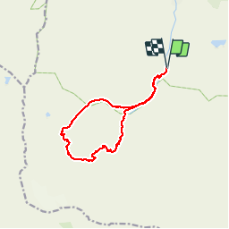

Length
13.2 km

Max alt
2679 m

Uphill gradient
736 m
Km-Effort
23 km

Min alt
1942 m

Downhill gradient
736 m
Boucle
Yes
Creation date :
2016-08-25 00:00:00.0
Updated on :
2016-08-25 00:00:00.0
5h56
Difficulty : Easy

FREE GPS app for hiking
 SityTrail
IGN / Geographical institutes
SityTrail Plus
The world is yours!
About
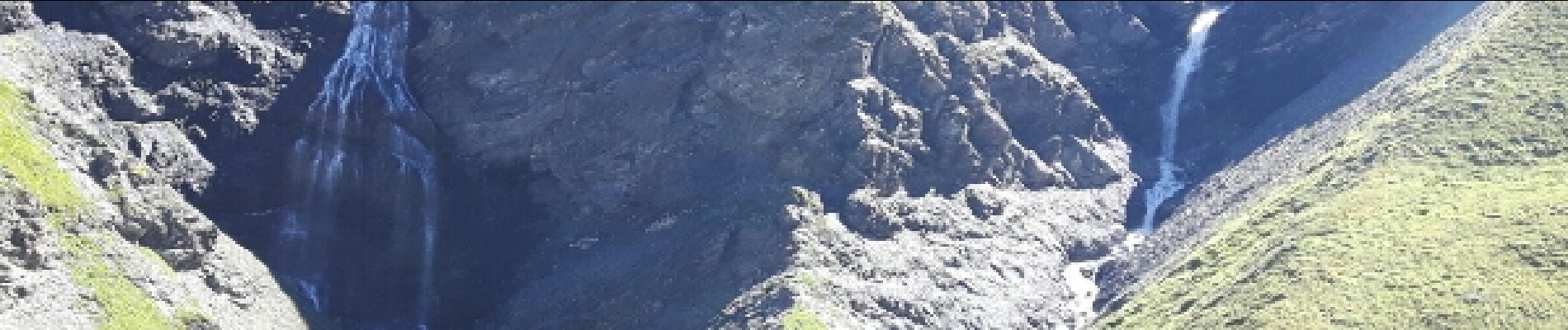
Trail Walking of 13.2 km to be discovered at Auvergne-Rhône-Alpes, Savoy, Val-d'Isère. This trail is proposed by amiral13.
Photos


Positioning
Country:
France
Region :
Auvergne-Rhône-Alpes
Department/Province :
Savoy
Municipality :
Val-d'Isère
Location:
Unknown
Start:(Dec)
Start:(UTM)
341378 ; 5031836 (32T) N.
Comments