


Puigmal d'Err et petit Puigmal de Sègre

jcmartin
User
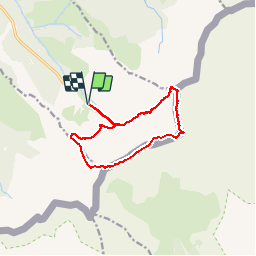

Length
12.3 km

Max alt
2904 m

Uphill gradient
993 m
Km-Effort
26 km

Min alt
2030 m

Downhill gradient
996 m
Boucle
Yes
Creation date :
2016-08-26 00:00:00.0
Updated on :
2016-08-26 00:00:00.0
5h07
Difficulty : Difficult

FREE GPS app for hiking
 SityTrail
IGN / Geographical institutes
SityTrail Plus
The world is yours!
About
Trail Walking of 12.3 km to be discovered at Occitania, Pyrénées-Orientales, Err. This trail is proposed by jcmartin.
Positioning
Country:
France
Region :
Occitania
Department/Province :
Pyrénées-Orientales
Municipality :
Err
Location:
Unknown
Start:(Dec)
Start:(UTM)
424626 ; 4693553 (31T) N.
Comments