


FA Salzbach-Uff Rain-Wadenbach- Schnupfenried-Col du Platzerwaesel et retour

patrickbeyrath
User
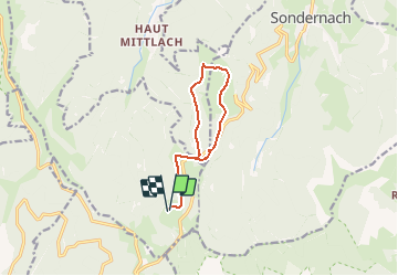

Length
9.6 km

Max alt
1196 m

Uphill gradient
270 m
Km-Effort
13.2 km

Min alt
1076 m

Downhill gradient
270 m
Boucle
Yes
Creation date :
2018-10-13 05:52:23.064
Updated on :
2018-10-13 05:52:23.071
3h02
Difficulty : Medium

FREE GPS app for hiking
 SityTrail
IGN / Geographical institutes
SityTrail Plus
The world is yours!
About
Trail Walking of 9.6 km to be discovered at Grand Est, Haut-Rhin, Metzeral. This trail is proposed by patrickbeyrath.
Positioning
Country:
France
Region :
Grand Est
Department/Province :
Haut-Rhin
Municipality :
Metzeral
Location:
Unknown
Start:(Dec)
Start:(UTM)
352932 ; 5313434 (32T) N.
Comments