


Lurien tour du

Mendilaze
User
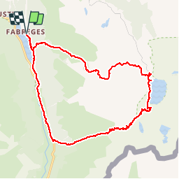

Length
22 km

Max alt
2337 m

Uphill gradient
1580 m
Km-Effort
43 km

Min alt
1247 m

Downhill gradient
1579 m
Boucle
Yes
Creation date :
2017-11-17 00:00:00.0
Updated on :
2017-11-17 00:00:00.0
9h02
Difficulty : Medium

FREE GPS app for hiking
 SityTrail
IGN / Geographical institutes
SityTrail Plus
The world is yours!
About
Trail Walking of 22 km to be discovered at New Aquitaine, Pyrénées-Atlantiques, Laruns. This trail is proposed by Mendilaze.
Description
depuis le parking du lac de Fabrèges
Positioning
Country:
France
Region :
New Aquitaine
Department/Province :
Pyrénées-Atlantiques
Municipality :
Laruns
Location:
Unknown
Start:(Dec)
Start:(UTM)
712648 ; 4750671 (30T) N.
Comments