Trail Walking Pierre-Châtel - LA PIERRE PERCÉE-PIERRE CHATEL-29-08-2016 - Photo

LA PIERRE PERCÉE-PIERRE CHATEL-29-08-2016

 RD78-38
RD78-38

User

© OpenStreetMap contributors
Length
Length
13.6 km
Max alt
Max alt
1275 m
Uphill gradient
Uphill gradient
445 m
Km-Effort
Km-Effort  
19.5 km
Min alt
Min alt
932 m
Downhill gradient
Downhill gradient
447 m
Boucle
Boucle
Yes
Creation date :
2016-09-04 00:00:00.0
Updated on :
2020-07-11 00:22:51.629

(0 Reviews)

Walking
Walking
4h13
Difficulty : Very easy

Scan this QR Code to open this trail in the SityTrail application

FREE GPS app for hiking

Logo SityTrail SityTrail

IGN / Geographical institutes

Download SityTrail from the App Store Download SityTrail from Google Play

Logo SityTrail SityTrail World

The world is yours!

Download SityTrail from the App Store Download SityTrail from Google Play Download SityTrail on Huawei AppGallery

About

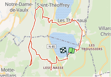
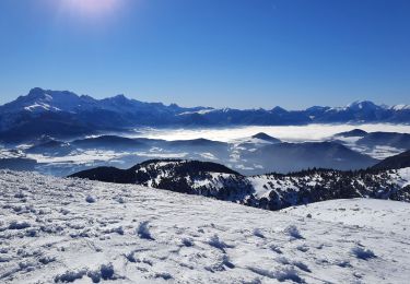
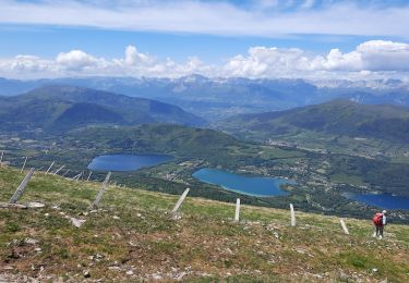
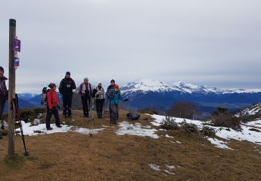
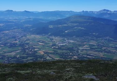
Trail Walking of 13.6 km to be discovered at Auvergne-Rhône-Alpes, Isère, Pierre-Châtel. This trail is proposed by RD78-38.

Description

Ballade plus que Randonnée. Aller et retour vers la pierre percée sans grand intérêt (aucune vue, traversée d'une forêt seulement). Seule la pierre percée et sa vue présentent un intérêt.

Elevation profile

Photos

Positioning

Country:
France
Region :
Auvergne-Rhône-Alpes
Department/Province :
Isère
Municipality :
Pierre-Châtel
Location:
Unknown
Start:(UTM)
719248 ; 4983213 (31T) N.

Trails nearby

Trail Mountain bike Pierre-Châtel - Tour des lacs Pierre-Chatel - Photo
Mountain bike
Vicenzozo

Mountain bike

Very easy
(1)
Pierre-Châtel, Auvergne-Rhône-Alpes, Isère, France
32 km | 46 km-effort
4h 28min
Yes
Trail Walking La Motte-Saint-Martin - connex - Photo
Walking
paulin bruno

Walking

Medium
La Motte-Saint-Martin, Auvergne-Rhône-Alpes, Isère, France
15.6 km | 28 km-effort
6h 26min
Yes
Trail Mountain bike La Motte-d'Aveillans - Le Sénépy depuis Les Signaraux - Photo
Mountain bike
patjobou

Mountain bike

Medium
La Motte-d'Aveillans, Auvergne-Rhône-Alpes, Isère, France
20 km | 32 km-effort
3h 39min
Yes
Trail Walking La Motte-d'Aveillans - Col du Sénépy et Pierre Plantée depuis les Signaraux - Photo
Walking
GuyVachet

Walking

Medium
La Motte-d'Aveillans, Auvergne-Rhône-Alpes, Isère, France
10.2 km | 15.8 km-effort
5h 39min
Yes
Trail Walking Saint-Honoré - Le Grand Serre - Photo
Walking
GuyVachet

Walking

Difficult
Saint-Honoré, Auvergne-Rhône-Alpes, Isère, France
13.1 km | 23 km-effort
6h 0min
Yes
Trail Touring skiing Saint-Honoré - Le perollier, le Grand Serre - Photo
Touring skiing
nadd73

Touring skiing

Medium
Saint-Honoré, Auvergne-Rhône-Alpes, Isère, France
15.4 km | 33 km-effort
6h 29min
Yes
Trail Touring skiing Saint-Honoré - Tabor de la Mûre - Photo
Touring skiing
nadd73

Touring skiing

Easy
Saint-Honoré, Auvergne-Rhône-Alpes, Isère, France
10.7 km | 24 km-effort
5h 8min
Yes
Trail Walking La Motte-d'Aveillans - Les Signaraux - La Pierre Plantée  - Le Serre de L'Horizon - Le Col du Sénépy - Photo
Walking
patjobou

Walking

Easy
La Motte-d'Aveillans, Auvergne-Rhône-Alpes, Isère, France
8.7 km | 14.3 km-effort
2h 48min
Yes
Trail Walking Saint-Honoré - Tabor de Matheysine en circuit - Photo
Walking
Emelle

Walking

Medium
Saint-Honoré, Auvergne-Rhône-Alpes, Isère, France
13.2 km | 25 km-effort
5h 55min
Yes


Close
My subscriptions