


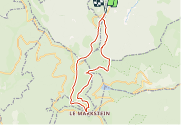
Col du Platzerwaesel

oscar1
User

Length
14.2 km

Max alt
1276 m

Uphill gradient
402 m
Km-Effort
19.6 km

Min alt
1104 m

Downhill gradient
402 m
Boucle
Yes
Creation date :
2016-09-06 00:00:00.0
Updated on :
2019-02-10 11:17:52.216
4h09
Difficulty : Difficult

FREE GPS app for hiking
 SityTrail
IGN / Geographical institutes
SityTrail Plus
The world is yours!
About
Trail Walking of 14.2 km to be discovered at Grand Est, Haut-Rhin, Mittlach. This trail is proposed by oscar1.
Positioning
Country:
France
Region :
Grand Est
Department/Province :
Haut-Rhin
Municipality :
Mittlach
Location:
Unknown
Start:(Dec)
Start:(UTM)
353931 ; 5314755 (32T) N.
Comments