


LAROQUE DES ALBÈRES

josy31
User
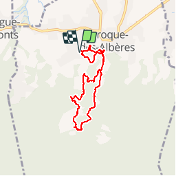

Length
7.3 km

Max alt
321 m

Uphill gradient
263 m
Km-Effort
10.8 km

Min alt
105 m

Downhill gradient
262 m
Boucle
Yes
Creation date :
2016-09-20 00:00:00.0
Updated on :
2016-09-20 00:00:00.0
2h45
Difficulty : Easy

FREE GPS app for hiking
 SityTrail
IGN / Geographical institutes
SityTrail Plus
The world is yours!
About
Trail Walking of 7.3 km to be discovered at Occitania, Pyrénées-Orientales, Laroque-des-Albères. This trail is proposed by josy31.
Description
Au-dessus du village une jolie boucle
Positioning
Country:
France
Region :
Occitania
Department/Province :
Pyrénées-Orientales
Municipality :
Laroque-des-Albères
Location:
Unknown
Start:(Dec)
Start:(UTM)
494079 ; 4707598 (31T) N.
Comments