


Col d'Aussois - Pointe de l'Observatoire

direction-ot
User
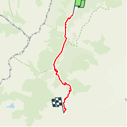

Length
7.8 km

Max alt
2914 m

Uphill gradient
1159 m
Km-Effort
19.4 km

Min alt
1759 m

Downhill gradient
8 m
Boucle
No
Creation date :
2016-09-21 00:00:00.0
Updated on :
2016-09-21 00:00:00.0
6h45
Difficulty : Difficult

FREE GPS app for hiking
 SityTrail
IGN / Geographical institutes
SityTrail Plus
The world is yours!
About
Trail Walking of 7.8 km to be discovered at Auvergne-Rhône-Alpes, Savoy, Pralognan-la-Vanoise. This trail is proposed by direction-ot.
Description
Itinéraire AR. Distance Col d'Aussois indiquée, Pointe de l'observatoire accessible en 15mn supplémentaires.
Positioning
Country:
France
Region :
Auvergne-Rhône-Alpes
Department/Province :
Savoy
Municipality :
Pralognan-la-Vanoise
Location:
Unknown
Start:(Dec)
Start:(UTM)
319416 ; 5023220 (32T) N.
Comments