Trail Cycle Hirson - Véloroute3 de Hirson à Maubeuge - Photo

Véloroute3 de Hirson à Maubeuge

 destras
destras

User

© OpenStreetMap contributors
Length
Length
66 km
Max alt
Max alt
266 m
Uphill gradient
Uphill gradient
722 m
Km-Effort
Km-Effort  
76 km
Min alt
Min alt
126 m
Downhill gradient
Downhill gradient
766 m
Boucle
Boucle
No
Creation date :
2016-10-01 00:00:00.0
Updated on :
2016-10-01 00:00:00.0

(0 Reviews)

Cycle
Cycle
3h10
Difficulty : Medium

Scan this QR Code to open this trail in the SityTrail application

FREE GPS app for hiking

Logo SityTrail SityTrail

IGN / Geographical institutes

Download SityTrail from the App Store Download SityTrail from Google Play

Logo SityTrail SityTrail World

The world is yours!

Download SityTrail from the App Store Download SityTrail from Google Play Download SityTrail on Huawei AppGallery

About

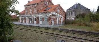
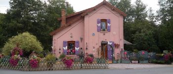
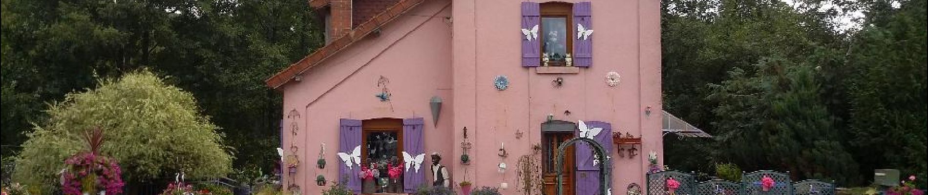
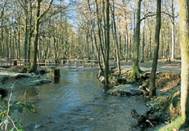
Trail Cycle of 66 km to be discovered at Hauts-de-France, Aisne, Hirson. This trail is proposed by destras.

Description

La ScandIbérique au nord de la France de Hirson à Maubeuge. VTC conseillé absolument.

Elevation profile

Photos

Points of interest

Point of interest Solre-le-Château - Clocher de Soler - Photo
destras
SOLRE-LE-CHÂTEAU 
Point of interest Ferrière-la-Grande - Ancienne gare  - Photo
destras
FERRIÈRE-LA-GRANDE 
Point of interest Choisies - maison de poupées - Photo
destras

Positioning

Country:
France
Region :
Hauts-de-France
Department/Province :
Aisne
Municipality :
Hirson
Location:
Unknown
Start:(UTM)
577959 ; 5530022 (31U) N.

Trails nearby

Trail Nordic walking Hirson - 2023-10-02_06h00m24_13KMS MARCHE  - Photo
Nordic walking
PasGoe

Nordic walking

Medium
(1)
Hirson, Hauts-de-France, Aisne, France
7.8 km | 9.6 km-effort
Unknown
Yes
Trail Nordic walking Hirson - 2023-10-02_06h00m24_13KMS MARCHE  - Photo
Nordic walking
PasGoe

Nordic walking

Medium
(1)
Hirson, Hauts-de-France, Aisne, France
12.4 km | 15.2 km-effort
Unknown
Yes
Trail Walking Hirson - de Hirson, au domaine de Dangy, jusqu'à Signy le Petit - Photo
Walking
jeff2

Walking

Medium
Hirson, Hauts-de-France, Aisne, France
22 km | 25 km-effort
7h 58min
No
Trail Running Éparcy - Eparcy - Photo
Running
Michel Tondus

Running

Éparcy, Hauts-de-France, Aisne, France
5.5 km | 6.5 km-effort
39min
Yes
Trail Mountain bike Saint-Michel - Rando VTT des Verts de Terre 2018 - 70KM : 1200m - Photo
Mountain bike
D4Y.be

Mountain bike

Medium
Saint-Michel, Hauts-de-France, Aisne, France
76 km | 92 km-effort
4h 52min
Yes
Trail Walking Hirson - Entre l'Oise et le Thon - Hirson - Photo
Walking
tracegps

Walking

Medium
(1)
Hirson, Hauts-de-France, Aisne, France
52 km | 60 km-effort
3h 0min
Yes
Trail sport Hirson - Waterval - Photo
sport
zayneb aftat

sport

Very easy
Hirson, Hauts-de-France, Aisne, France
3.6 km | 4 km-effort
Unknown
No
Trail Mountain bike Saint-Michel - Le pré-Lorquin - Photo
Mountain bike
tracegps

Mountain bike

Very difficult
Saint-Michel, Hauts-de-France, Aisne, France
20 km | 25 km-effort
4h 0min
Yes
Trail Walking Saint-Michel - L'abbaye de Saint-Michel - Photo
Walking
tracegps

Walking

Easy
(1)
Saint-Michel, Hauts-de-France, Aisne, France
5.8 km | 7.4 km-effort
1h 30min
Yes


Close
My subscriptions