


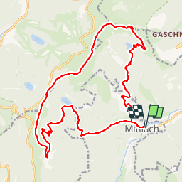
Mittlach 3 lacs-4 sommets 03-10-2016

LaurentGILG
User

Length
23 km

Max alt
1355 m

Uphill gradient
1382 m
Km-Effort
42 km

Min alt
527 m

Downhill gradient
1381 m
Boucle
Yes
Creation date :
2019-01-20 20:50:27.792
Updated on :
2019-01-20 20:50:27.881
8h28
Difficulty : Very difficult

FREE GPS app for hiking
 SityTrail
IGN / Geographical institutes
SityTrail Plus
The world is yours!
About
Trail Walking of 23 km to be discovered at Grand Est, Haut-Rhin, Mittlach. This trail is proposed by LaurentGILG.
Description
Mittlach, Lac du Fischboedle, Lac du Schiessrothried, Le Honeck, Le Kastelberg, Le Rainkopf; Rotenbacchkopf, Lac d'Altenweiher, Mittlach
Positioning
Country:
France
Region :
Grand Est
Department/Province :
Haut-Rhin
Municipality :
Mittlach
Location:
Unknown
Start:(Dec)
Start:(UTM)
353320 ; 5318627 (32U) N.
Comments