Trail Walking Zarautz - Txakoli - Photo
© OpenStreetMap contributors
Length
Length
18 km
Max alt
Max alt
263 m
Uphill gradient
Uphill gradient
650 m
Km-Effort
Km-Effort  
27 km
Min alt
Min alt
-2 m
Downhill gradient
Downhill gradient
652 m
Boucle
Boucle
Yes
Creation date :
2016-10-16 00:00:00.0
Updated on :
2016-10-16 00:00:00.0

(0 Reviews)

Walking
Walking
3h06
Difficulty : Easy

Scan this QR Code to open this trail in the SityTrail application

FREE GPS app for hiking

Logo SityTrail SityTrail

IGN / Geographical institutes

Download SityTrail from the App Store Download SityTrail from Google Play

Logo SityTrail SityTrail World

The world is yours!

Download SityTrail from the App Store Download SityTrail from Google Play Download SityTrail on Huawei AppGallery

About

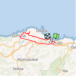
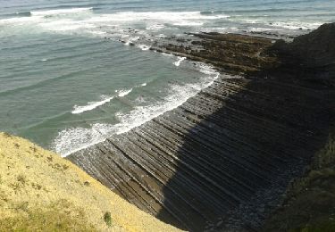
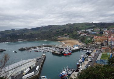
Trail Walking of 18 km to be discovered at Autonomous Community of the Basque Country, Gipuzkoa, Zarautz. This trail is proposed by laureberger1.

Description

Balade dans les vignobles de Txacoli. Retour en train de Zumaïa à Zarautz.

Elevation profile

Photos

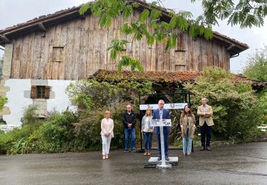
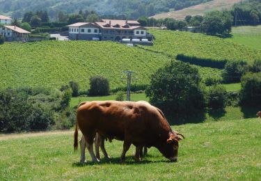
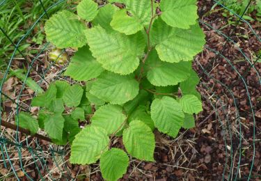
45 photos in total. Please click on a photo to see them all in the gallery.

Points of interest

Point of interest Zumaia - gare de zumaïa - Photo
laureberger1
Point of interest Zarautz - Gare de Zarautz - Photo
laureberger1

Positioning

Country:
Spain
Region :
Autonomous Community of the Basque Country
Department/Province :
Gipuzkoa
Municipality :
Zarautz
Location:
Unknown
Start:(Dec)
Start:(UTM)
566540 ; 4792680 (30T) N.

Trails nearby

Trail On foot Aia - SL-GI 4001 PAGOETA Agorregi: burnia eta ura - Photo
On foot
PRO

On foot

Easy
Aia, Autonomous Community of the Basque Country, Gipuzkoa, Spain
3.6 km | 5.4 km-effort
1h 14min
Yes
Trail Walking Zarautz - zarautz getaria  - Photo
Walking
henribatut

Walking

Easy
Zarautz, Autonomous Community of the Basque Country, Gipuzkoa, Spain
14.4 km | 21 km-effort
4h 0min
Yes
Trail On foot Aia - SL-GI 4002 PAGOETA Faunaren ibilbidea - Photo
On foot
PRO

On foot

Easy
Aia, Autonomous Community of the Basque Country, Gipuzkoa, Spain
6.2 km | 9.4 km-effort
2h 8min
Yes
Trail Walking Getaria - JFT YB Étape 26 24-5-2014  - Photo
Walking
jeff2

Walking

Easy
Getaria, Autonomous Community of the Basque Country, Gipuzkoa, Spain
18 km | 28 km-effort
5h 7min
No
Trail Walking Zarautz - G4 getaria - Photo
Walking
LouisROGER

Walking

Medium
Zarautz, Autonomous Community of the Basque Country, Gipuzkoa, Spain
5.9 km | 7.7 km-effort
3h 0min
No
Trail Walking Getaria - Getaria zaraost - Photo
Walking
CEFAMALI

Walking

Getaria, Autonomous Community of the Basque Country, Gipuzkoa, Spain
11.4 km | 15 km-effort
6h 32min
Yes
Trail Walking Orio - Orio-Deba - Photo
Walking
dagobert5612

Walking

Difficult
Orio, Autonomous Community of the Basque Country, Gipuzkoa, Spain
30 km | 41 km-effort
8h 45min
No
Trail Walking Getaria - 003 Getaria - Ibiri - Photo
Walking
Bonsaicd

Walking

Very difficult
Getaria, Autonomous Community of the Basque Country, Gipuzkoa, Spain
19.2 km | 31 km-effort
6h 26min
No
Trail Walking Getaria - 03 Getaria Deba - Photo
Walking
Bonsaicd

Walking

Easy
Getaria, Autonomous Community of the Basque Country, Gipuzkoa, Spain
14 km | 23 km-effort
5h 3min
No


Close
My subscriptions