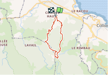
Trail Walking Argelès-sur-Mer - valmy-LaMassane_T - Photo
 force
force

User

© OpenStreetMap contributors
Length
Length
12 km
Max alt
Max alt
775 m
Uphill gradient
Uphill gradient
740 m
Km-Effort
Km-Effort  
22 km
Min alt
Min alt
51 m
Downhill gradient
Downhill gradient
739 m
Boucle
Boucle
Yes
Creation date :
2016-10-18 00:00:00.0
Updated on :
2024-07-13 08:15:57.151

(0 Reviews)

Walking
Walking
4h35
Difficulty : Unknown

Scan this QR Code to open this trail in the SityTrail application

FREE GPS app for hiking

Logo SityTrail SityTrail

IGN / Geographical institutes

Download SityTrail from the App Store Download SityTrail from Google Play

Logo SityTrail SityTrail Plus

The world is yours!

Download SityTrail from the App Store Download SityTrail from Google Play Download SityTrail on Huawei AppGallery

About

Trail Walking of 12 km to be discovered at Occitania, Pyrénées-Orientales, Argelès-sur-Mer. This trail is proposed by force.

Description

Autre voie pour aller à la Massane. Quelques passages étroits et accidentés sur la partie descendante. Belles randonnées avec Chapelle restaurée, la Massane, menhirs et château, sans oublier les paysages des environs d'Arglès, <collioure etc ...

Elevation profile

Photos

Positioning

Country:
France
Region :
Occitania
Department/Province :
Pyrénées-Orientales
Municipality :
Argelès-sur-Mer
Location:
Unknown
Start:(UTM)
502187 ; 4708845 (31T) N.


Close
My subscriptions