


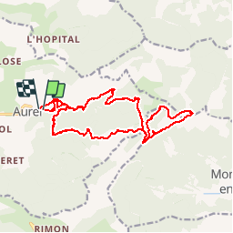

14.2 km | 23 km-effort


User


FREE GPS app for hiking
 SityTrail
IGN / Geographical institutes
SityTrail World
The world is yours!
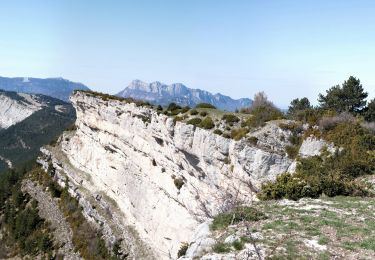
Trail Walking of 19.1 km to be discovered at Auvergne-Rhône-Alpes, Drôme, Aurel. This trail is proposed by LUCAS26.

Walking

Walking
Walking

Walking
Walking

Walking
Walking
Walking
Walking
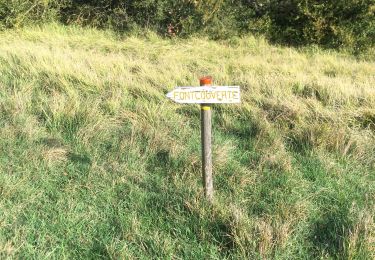
Randonnée sympa en sous bois mais petit bémol sur le balisage