


Toussaint 2015 j3

Airelle
User
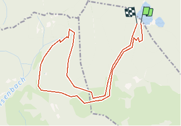

Length
5.5 km

Max alt
1053 m

Uphill gradient
369 m
Km-Effort
10.4 km

Min alt
825 m

Downhill gradient
352 m
Boucle
Yes
Creation date :
2016-12-16 00:00:00.0
Updated on :
2016-12-16 00:00:00.0
2h10
Difficulty : Unknown

FREE GPS app for hiking
 SityTrail
IGN / Geographical institutes
SityTrail Plus
The world is yours!
About
Trail Walking of 5.5 km to be discovered at Grand Est, Haut-Rhin, Oberbruck. This trail is proposed by Airelle.
Positioning
Country:
France
Region :
Grand Est
Department/Province :
Haut-Rhin
Municipality :
Oberbruck
Location:
Unknown
Start:(Dec)
Start:(UTM)
343315 ; 5299768 (32T) N.
Comments